This article may contain links to products and services we use and recommend. We may receive compensation when you click on links to those products. For more information, see our Disclosure Policy.
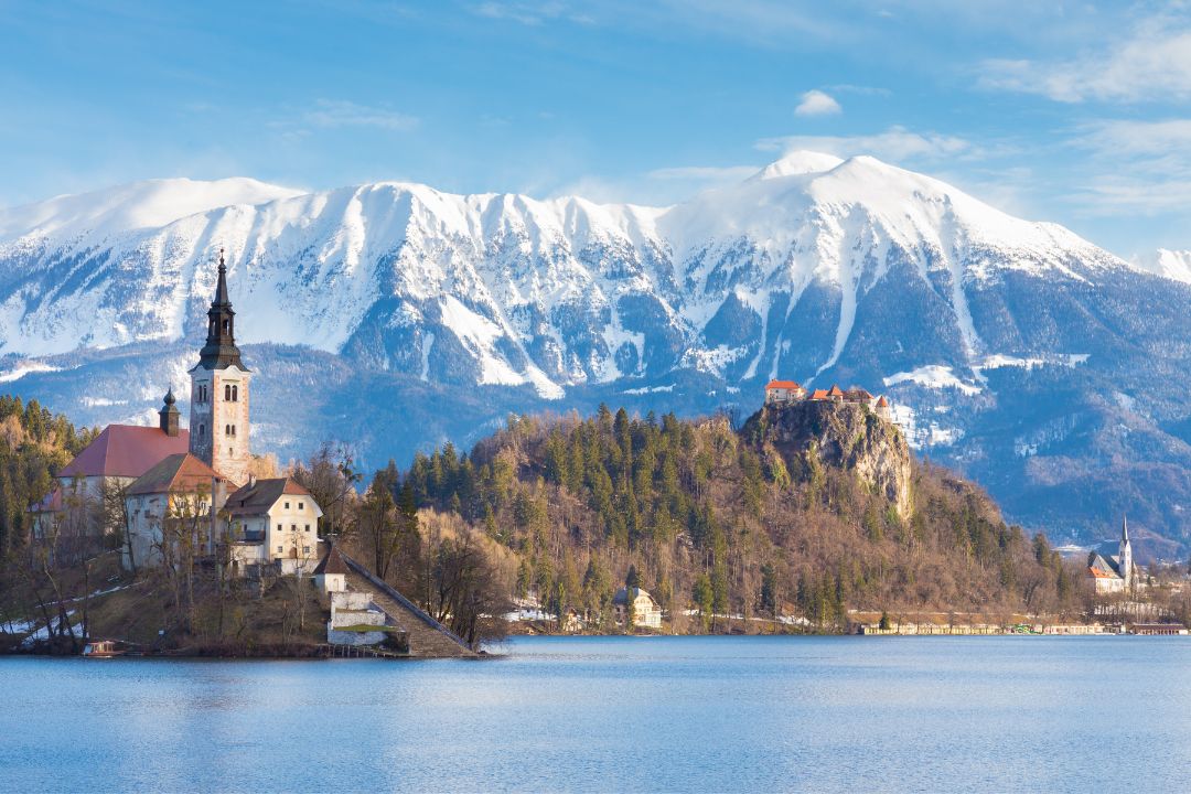
We have seen many stunning mountains on our travels. The Andes in Ecuador, the Rocky Mountains in Colorado and New Zealand’s Aoraki/Mt Cook National Park are among our favourites. After exploring Slovenia recently, we have now added the Julian Alps. If you are heading to Slovenia we invite you to come and visit to see the beauty of the Julian Alps for yourself. We have prepared this three-day itinerary for you.
Planning your trip to the Julian Alps last minute?
Book your transportation to/from and around the Julian Alps keeping your carbon footprint in mind:
Find your perfect accommodation in the Julian Alps with Booking.com. We recommend these traditional, small-scale and centrally-located options:
Explore the wonders of the Julian Alps and beyond with the best tours and activities powered by Viator. We recommend these sustainable options with local providers:
We use and recommend Airalo eSIMs for affordable, hassle-free internet access in 200+ destinations. Activate before you arrive and get online instantly.
What and where are the Julian Alps?
The Julian Alps are a mountain range stretching from north-eastern Italy into north-western Slovenia. With 2,864 metres, Mt Triglav is the highest peak in the Julian Alps and Slovenia’s highest mountain. It also lent its name to Slovenia’s only National Park – Triglav National Park / Triglavski Narodni Park – which covers a large part of the Julian Alps.
Triglav National Park is also the source of the Soča River, which has carved a valley from the Julian Alps (where it’s most picturesque) all the way to the Adriatic. The river is well-known for its emerald green/turquoise colour (and infamous for the bloody World War I battles that occurred on its shores).
Key vantage points in the Julian Alps are Bohinj in the southeast, Kranjska Gora to the north and the Soča Valley to the (south-)west.
Map of Accommodation, Points of Interest, Eateries and Transport
Below is a map of the recommended accommodations, points of interest, eateries, and transport terminals or stops mentioned in this article.
Can you visit the Julian Alps from Ljubljana or Lake Bled?
The Julian Alps are easy to explore from Ljubljana or Lake Bled. You just need to add a few days – a day trip would not do it justice.
Our three-day itinerary starts at Vintgar Gorge near Lake Bled (assuming you visit Lake Bled and/or Ljubljana beforehand), takes you over the Alps from Kranjska Gora, and into and along the Soča Valley. From there, you can easily return to Ljubljana.
| Day | Suggestion |
|---|---|
| Day 1 | Drive over Vršič Pass to Bovec |
| Day 2 | Hike to Slap Virje, Visit Fort Kluze and hike to Fort Hermann |
| Day 3 | Hike to Slap Kosjak, Visit the Tolmin Gorges (and return to Ljubljana) |
In our view, three days is the absolute minimum to appreciate the natural beauty of the Julian Alps and the rich history and culture of the area. You could spend months in here exploring all the different hiking trails, so if you have more time add more days. You won’t regret it.
To explore the Julian Alps, it is best to hire a car.
You can do this itinerary by bus. However, it is not the easiest or most practical option, and it is limited to the summer months, as buses only travel across Vršič Pass (along Route 206) between 1 June and 30 September. For detailed information about the buses servicing the area check out the Soča Valley Tourism website.
How to find the best deals on rental cars
Most of the time, we use public transport to get us around. But occasionally, hiring a car or scooter just makes it easier or gets us to places we couldn't go without a set of wheels. Whenever we do hire a vehicle, our first point of call are local rental providers. A quick Google Maps search shows who's near us. We then check the reviews and only contact those other travellers had good experiences with.
If we can't find anyone we're comfortable with, we search for deals on aggregator websites. We've used Rentalcars.com and DiscoverCars.com in the past and had only good experiences with them. Both partner with trusted brands like Hertz, Avis, Budget or Europcar (and in some locations even local providers) - so you can compare car hire options in a similar way you'd compare accommodation offers across Agoda and Booking.com.
Day 1 – Drive over Vršič Pass
Nothing could have prepared us for the drive across Vršič Pass. It’s one of the most breathtaking mountain roads we’ve ever driven along. Between Kranjska Gora in the north and Bovec in the south, a total of 50 serpentines lead up to the 1,611m high mountain pass and then back down the other side.
The drive from Vintgar Gorge near Bled over Vršič Pass to Bovec is approximately 80km long and takes about 2 hours (without stops). With stops (including lunch and short hikes) as outlined below, it took us almost six hours.
We travelled along the road on the first weekend in June. With brilliant sunshine after days of rain, everyone seemed to be out and about. Motorcyclists from Austria, Porsche enthusiasts from Germany, cyclists from Italy… and of course heaps and heaps of hikers.
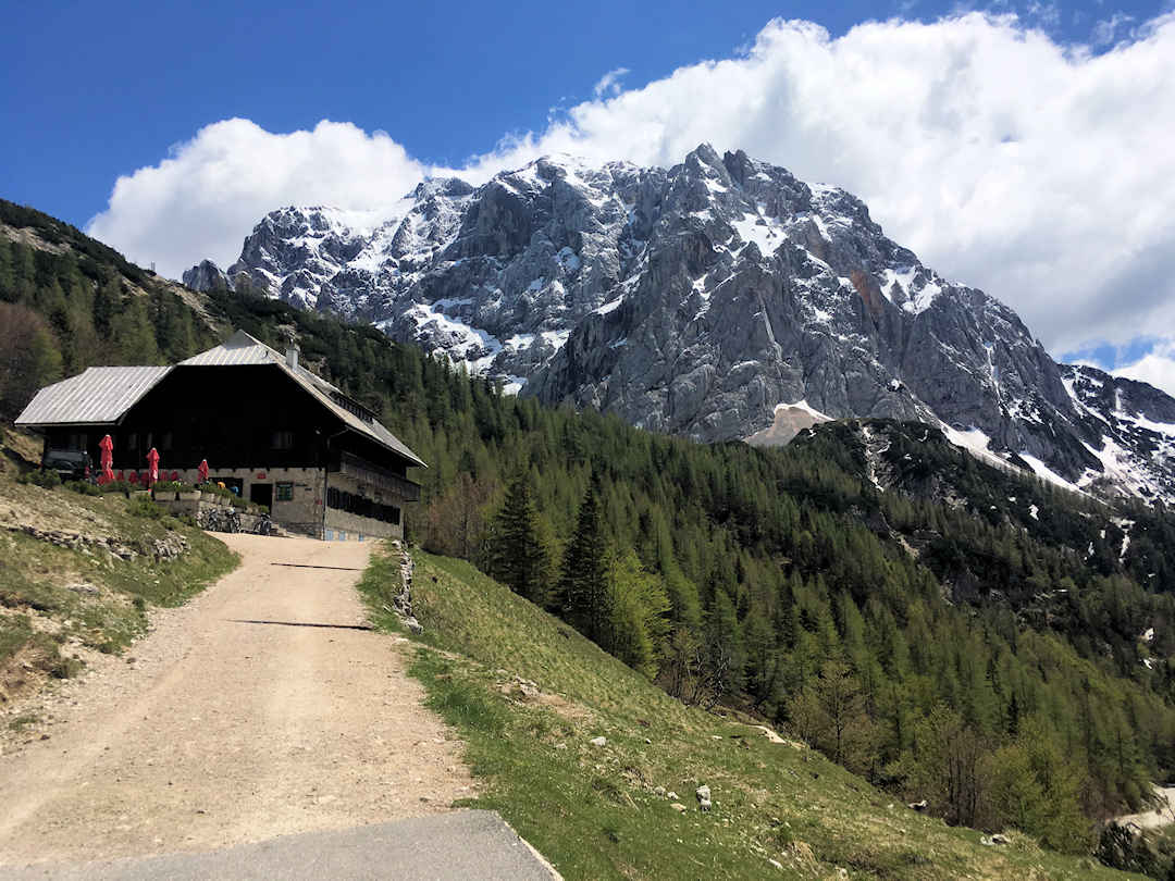
From Kranjska Gora to Bovec, route 206 over Vršič Pass is one of the most breath-taking mountain roads we’ve ever driven along
Ensure you stop along the way (where it’s safe to) to take in the scenery. Some great stopping points are (from north to south):
- Lake Jasna [Google Maps location]
- Russian Orthodox Chapel [Google Maps location]
- Lunch stops: Koča na Gozdu [Google Maps location]
- Vršič Pass [Google Maps location]
- Great Soča Gorge / Velika korita Soče [Google Maps location]
Lake Jasna
You pass Lake Jasna [Google Maps location] one kilometre after you turn onto Route 206 in Kranjska Gora. On a gorgeous day, the views across the artificial lake towards the mountains are stunning.

he views across Jasna Lake towards the mountains are absolutely stunning | Photo by Melanie Erhard on Pixabay
Russian Orthodox Chapel
Just after Serpentine Number Eight (all serpentines are numbered), there is a wooden chapel [Google Maps location] called Ruska kapelica na Vršiču. The chapel was built by the same Russian prisoners of war who built this mammoth road during World War I.
There is a small parking lot on the right after the bend. The chapel is on the left a short walk above the road.
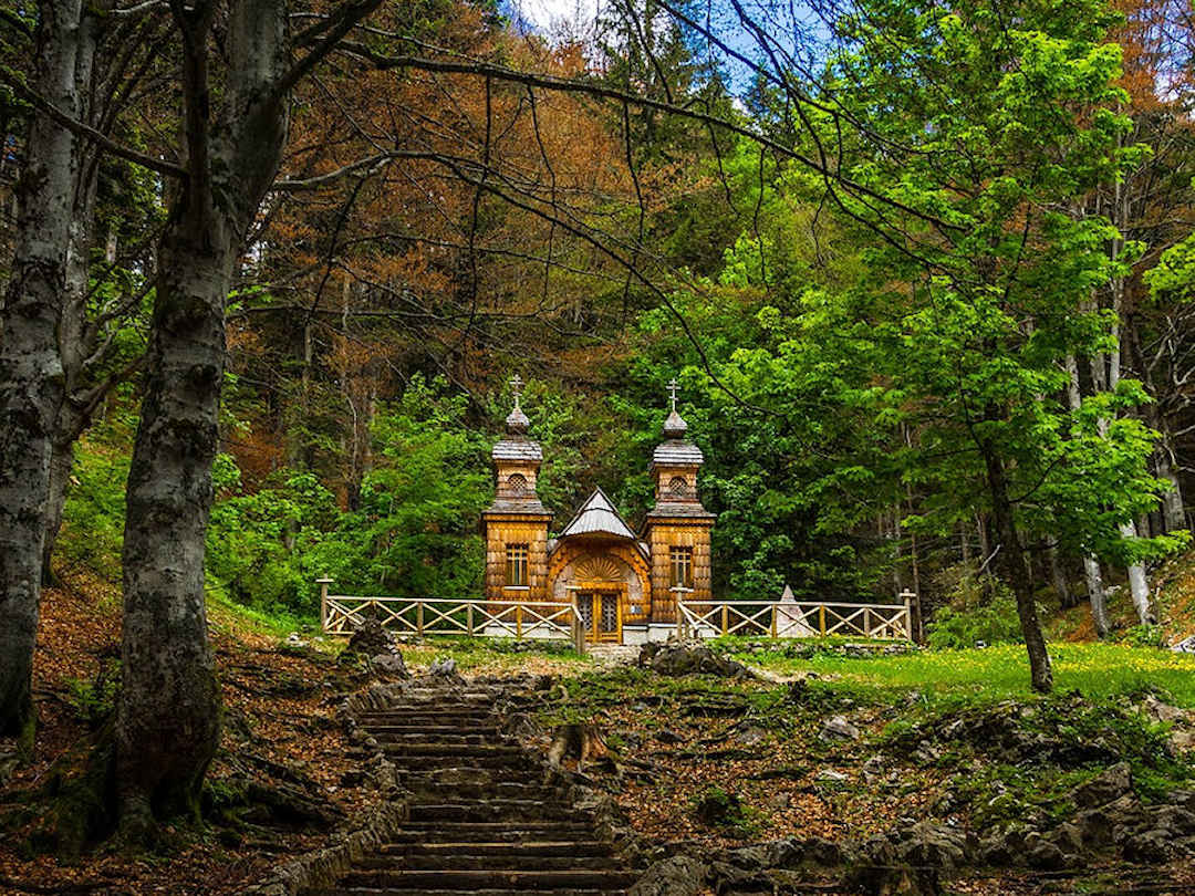
The wooden chapel was built by the same Russian POWs who built the road over Vršič Pass | Photo by Melanie Erhard on Pixabay
Lunch Stop
Koča na Gozdu (fittingly translated as the Chalet in the Forest) [Google Maps location] is about a kilometre after the chapel. It has a big parking lot and is a great spot for lunch. The mountain behind the chalet (Prisojnik or Prisank) is seriously impressive and has a large window to its right. While you can hike up to and through the window (from Vršič Pass), the hike is only recommended for experienced mountaineers.
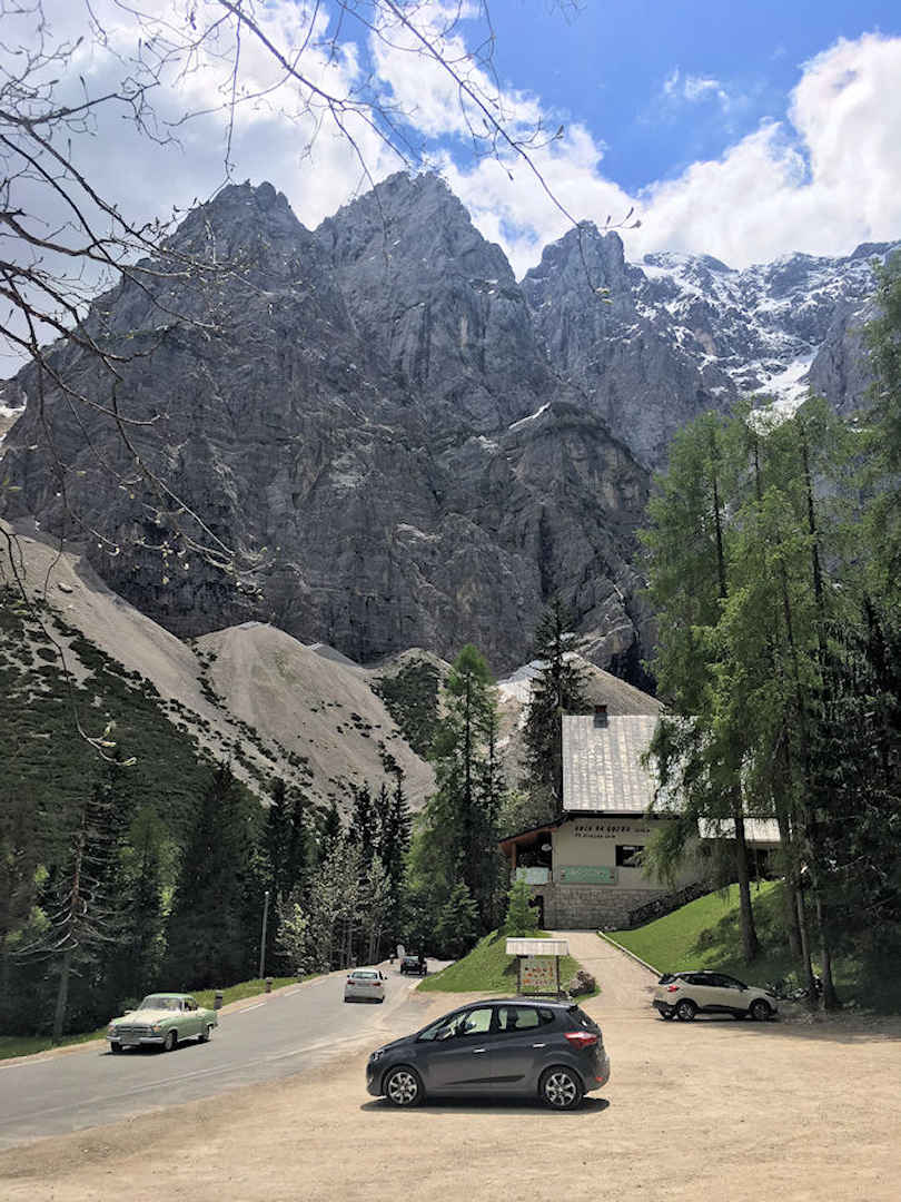
You can see mighty Prisojnik (or Prisank) all the way from Jasna Lake
Vršič Pass
About 3km further up, you finally reach Vršič Pass [Google Maps location]. At 1,611 metres above sea level, you can enjoy stunning vistas from the pass into the Trenta Valley to the south. The pass is the starting point for numerous hiking trails, so it can get quite busy here.
Park your car – it’s worth stopping here for a while. As a very minimum, do the easy loop hike to see Ajdovska Deklica (the Pagan Girl) [Google Maps location], a rock formation on the side of Prisank (yes, the same mountain with the window) that looks like a woman’s face. The easy hike takes just over an hour.

Don't you think this rock formation looks like a woman's face? | Photo on Wikimedia Commons
Great Soča Gorge / Velika Korita Soče
24 kilometres after the pass, you reach Great Soča Gorge / Velika Korita Soče. Turn off route 206 at the “Lepena/Velika Korita” sign (just before Kamp Soča), cross the bridge, turn right and park your car at the footbridge to Kamp Soča [Google Maps location]. Here you can walk along the Soča River gorge, take a swim or even join a rafting tour.
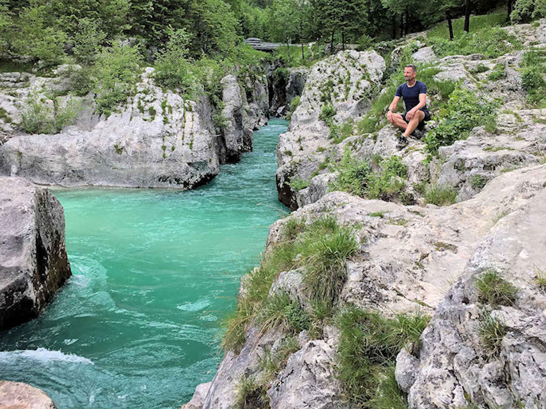
At Velika Korita, you can walk along the Soča river gorge, take a swim or even join a rafting tour
At a river bend further up the road, the Lepena River joins the Soča River. And four kilometres further up the Lepena River is the starting point of a short hike [Google Maps location] to Lepena Waterfall / Šunikov vodni gaj. The starting point also has a small parking lot [Google Maps location].
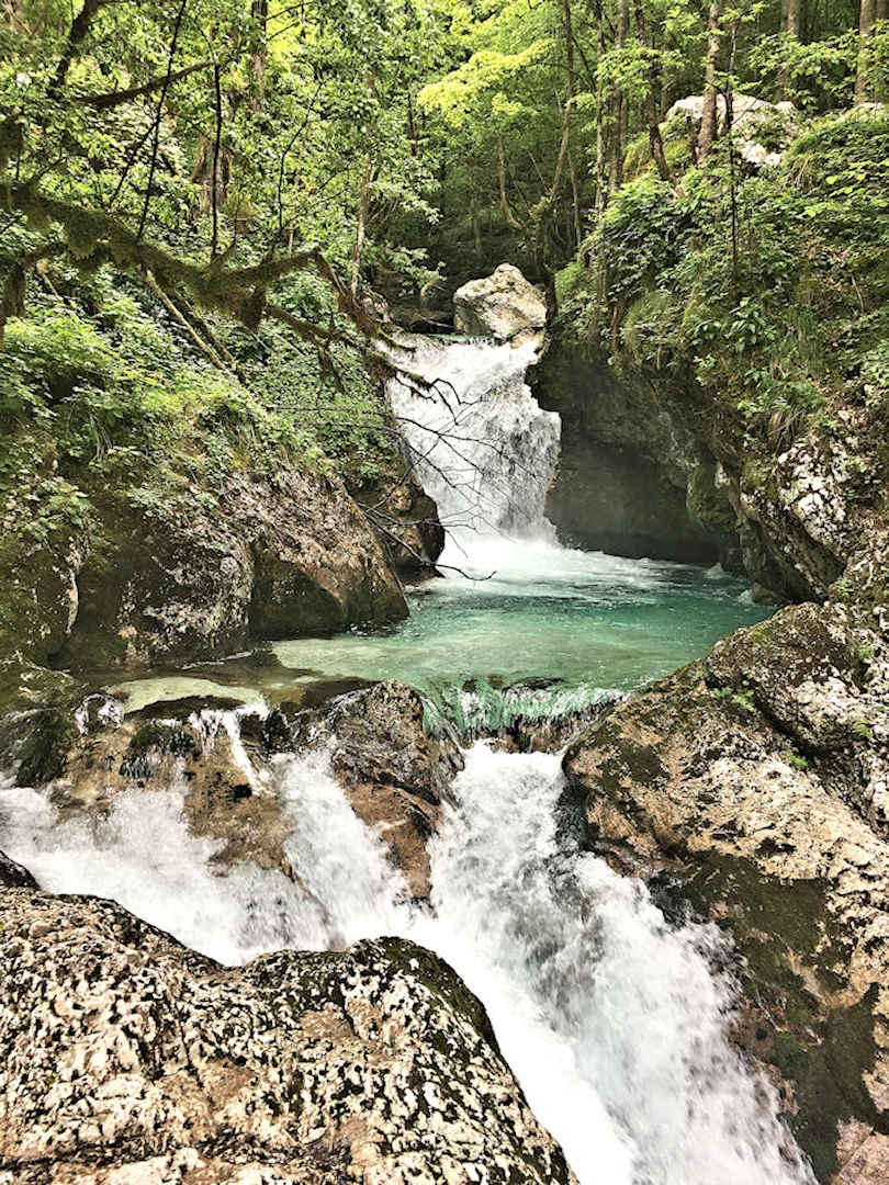
A short hike 4km east of Velika Korita takes you to the unspoiled Lepena Waterfall
From the Lepena turn-off/Kamp Soča, it’s another 10km drive until you reach Bovec.
If you don’t have your own transport: You can still enjoy the scenery along Route 206 (probably even more so as you don’t need to concentrate on driving). If you want to get off along the route to do a bit of hiking (if you don’t have too much luggage), the best spots would be either Vršič Pass or Velika Korita. We didn’t check it but you might be able to leave your luggage at Ticarjev Dom (Vršič Pass) or Kamp Soča (Velika Korita) during your hike (if you ask nicely).
Spend the night in Bovec at our recommended accommodation.
Never forget Srebrenica: A visitor guide to the Genocide Memorial
The countries that once made up the former Socialist Federal Republic of Yugoslavia (SFRY) have a hugely complex history. It took us nearly three months of travels through Slovenia, Croatia, Montenegro, Bosnia and Herzegovina, and Serbia to gain some understanding of what happened here (and why).
And at the Srebrenica Genocide Memorial in Bosnia and Herzegovina, we learnt what happened there and how to honour the victims. Our guide provides everything you need to know.
Day 2 – Hiking trails around Bovec
Bovec is the adventure capital of Slovenia. If hiking is not your thing you can pop into any of the many tour agencies around the small town and book whatever adventure activity your heart desires (and your wallet can afford).
We love the great outdoors, and with so much beauty around us, we did a few easy hikes around Bovec which we’re going to include in our itinerary.
Morning – Hike to Slap Virje
The first hike is an easy 10km loop trail to Slap Virje, a gorgeous waterfall formed by the Gljun creek (another tributary of the Soča). Simply follow the instructions in this hiking guide and use the Maps.Me app as back-up, especially as you’re trying to locate the start of the trailhead in Bovec.
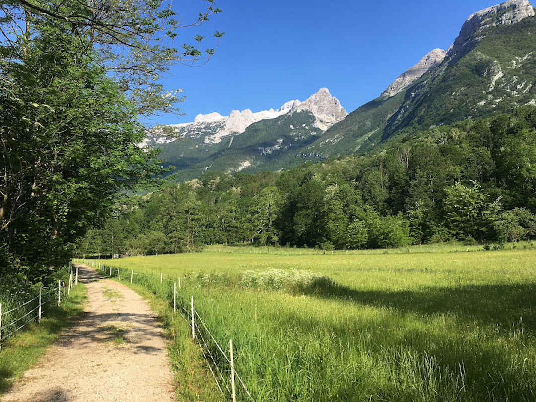
The trail to Slap Virje leads through pastures and the village of Plužna
The trail to Slap Virje follows the Alpe Adria Trail and leads through pastures and the village of Plužna. The trail can get a bit muddy but it’s beautiful and for the most part, well protected from the sun.

Another unspoiled waterfall in the Julian Alps: Slap Virje
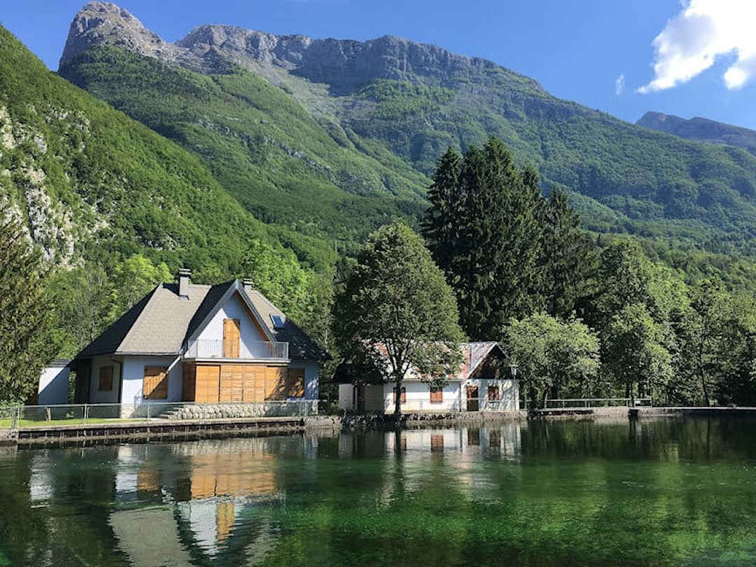
Not far from Slap Virje, the holding pond of the old hydroelectric plant reflects the surrounding mountains
You follow the Alpe Adria Trail for a little while longer, effectively walking on top of the hydro plant’s water pipes, but turn eventually left towards the golf course. The part from here back to Bovec past the Kanin cable car was less exciting for us. It is also more exposed to the sun, so make sure you start your hike early.
Lunch – Bovec
By the time you get back to Bovec, you’ll have worked up an appetite. We can recommend Paulacinka Creperie [Google Maps location] for delicious crepes and waffles and (if you’re after something more substantial) Terramystica [Google Maps location] which serves an international menu.
Afternoon – Fort Kluže and Fort Hermann
After lunch, we recommend visiting Fort Kluže and hiking up to Fort Hermann. The forts are about five kilometres northeast of Bovec on route 203 towards the Predil mountain pass and Italy.
If you don’t have your own transport, you can take the Bovec Hop-On/Hop-Off or rent a bike in Bovec and cycle there.

Present-day Fort Kluže is one of several forts that have stood at this strategically important point over the centuries
At Fort Kluže, the Koritnica River (also a tributary of the Soča) flows through a 70-metre deep, very narrow gorge – quite a spectacle of nature in itself.
Being such a strategic point, fortifications have stood here since the 15th century and were used to deter a number of invading armies, including the Ottomans in the 15th century and Napoleon’s army in the 18th century (which managed to destroy the fort).
Fort Kluže was rebuilt at the end of the 19th century and played an important role during the World War I Battles of Isonzo (the Italian name for the Soča River).
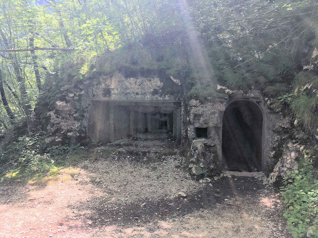
A hiking trail leads from Fort Kluže through a WWI tunnel up to Fort Hermann
Fort Hermann is located above Fort Kluže and can be reached via a hiking trail of about 1.5 kilometres each way. Cross the road from Fort Kluže but without crossing the bridge. A rocky path leads along the right side of the cliff face to the entrance of a tunnel. Walk through the tunnel and continue your hike up the mountain on the other side. For the most part, the trail up is forested and offers good protection from the sun. The trail however is narrow and steep in parts, so make sure you wear hiking shoes.
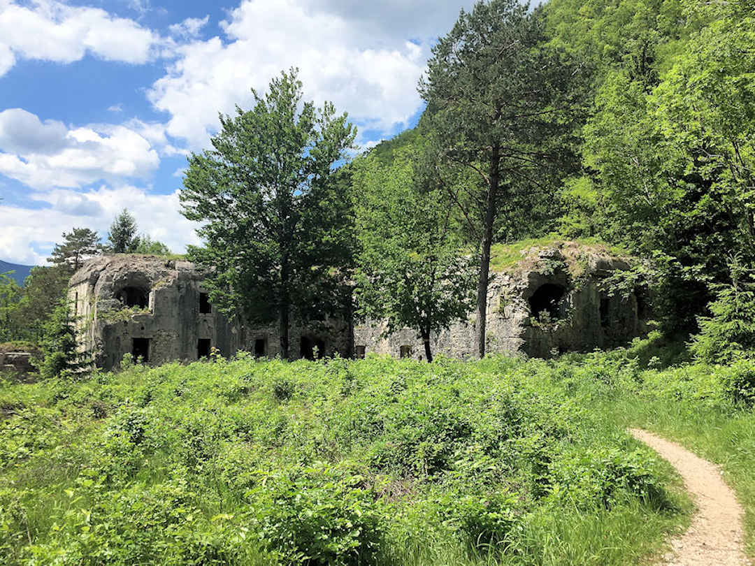
Fort Hermann is a spooky place with numerous holes in the surrounding area covered by vegetation - Make sure you stick to the paths.
Once you reach Fort Hermann stick to the trails that lead around and into the abandoned fort (as there are numerous holes in the ground covered by vegetation). There are various information signs that explain the history of the fort and what the different areas were used for.

On this map of Fort Hermann, you can see the ladder to the watch post and gun positions in the cliff face underneath the fort (KR)
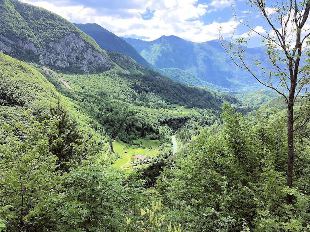
Views like this (from Fort Hermann over the Soča Valley) don't cost you a cent
Spend the night in Kobarid at our recommended accommodation, a 20-minute drive (or 30-minute bus ride) south of Bovec. Parking right in the centre of town is not free, but there are some free parking spots at the big parking lot on Stresova Ulica, only a few minutes walk away from the centre.
Day 3 – Hiking trails around Kobarid
Morning – Hike to Slap Kosjak
This morning, we suggest you hike to Slap Kosjak. This relatively easy 8-kilometre hike takes you not only to another gorgeous waterfall and across the turquoise waters of the Soča River but also past important historic sites, including remnants of World War I battles and an archaeological site dating back to the 4th century.
You can leave your car in Kobarid as the trail starts from the centre of town, first ascending along the Stations of the Cross path to the Italian Charnel House and Church of St Anthony and then leading into the forest. The Charnel House contains the remains of over 7,000 Italian soldiers who died in the Battles of Isonzo during World War I. It was foggy on the morning of our hike which gave the whole area an even more sombre and otherworldly feel.

The Charnel House in Kobarid contains the remains of over 7,000 Italian soldiers who died in the Battles of Isonzo during WWI
From the Charnel House, the path takes you (mostly) through the forest to Tonovcov Grad, an archaeological site located on top of a hill above the Soča river. Archaeologists found here items from the Stone Age, Iron Age, Roman period and Medieval times. The structures that can still be seen today date back to the 4th to 7th centuries and include dwellings, churches and a water reservoir. The views from here towards Kobarid and the Soča Valley are beautiful too.
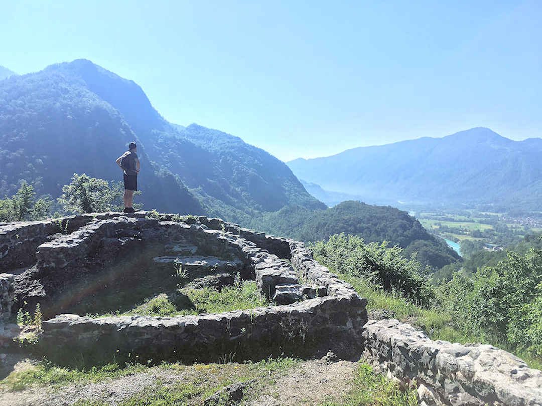
The archaeological site of Tonovcov Grad near Kobarid dates back to the 4th century, and the views from here are not too shabby either
From the archaeological site, the trail descends steeply towards the Soča River. On your way down, you pass through several trenches and fortifications used during World War I. After crossing Route 203, the trail continues its descent on the other side until it eventually reaches the river and a wooden suspension bridge.

To reach Slap Kosjak, you need to cross the Soča river at this suspension bridge
Cross the river and turn left and up the forest road until you reach a stone bridge that takes you over the lower parts of the waterfall. Cross the bridge and continue along the trail keeping right until you reach the upper parts of the waterfall. The waterfall flows into a cavern from above – an absolutely stunning sight.
While it was once free of charge to visit Slap Kosjak 24 hours a day, this is no longer the case. Between the stone bridge/lower parts of the waterfall and the upper parts, there is now an entry point. For further details including opening times and entry fees check out the Soča Valley Tourism website.
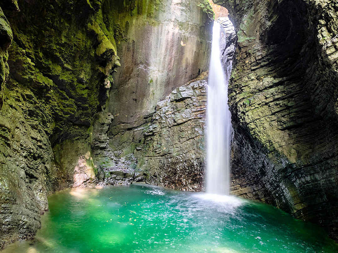
Slap Kosjak by Marcin Szmigiel on Unsplash
From the waterfall, you have to backtrack all the way to the suspension bridge. If you’re up for a swim in the cooling waters of the Soča River there is a small beach just before you reach the bridge (and a small path leads down to it). Otherwise, continue on this side of the river (without crossing the suspension bridge again).
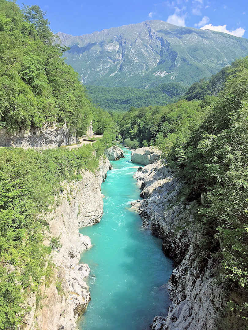
After your hike to Slap Kosjak, crossing Napoleon’s Bridge takes you back to Kobarid
The trail continues along the forest road (which turns to gravel shortly after the bridge), and you can enjoy stunning views along the Soča Valley. As you’re returning to Kobarid, the trail takes you across the Soča river once again, via Napoleon’s bridge.
Lunch – Kobarid
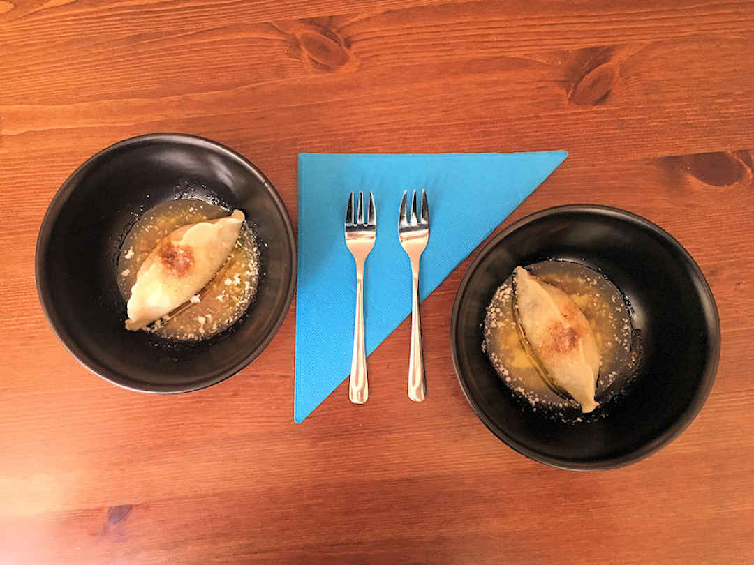
By the time you get back to Kobarid, it will be lunchtime. We suggest to stop at Hiša Polonka [Google Maps location] for some traditional dishes from the Soča Valley, including Kobarid’s very own štrukljis.
Afternoon – Visit the Tolmin Gorges (and return to Ljubljana)
After a good rest and delicious meal, you are ready for your final activity in the Julian Alps: the Tolmin Gorges.
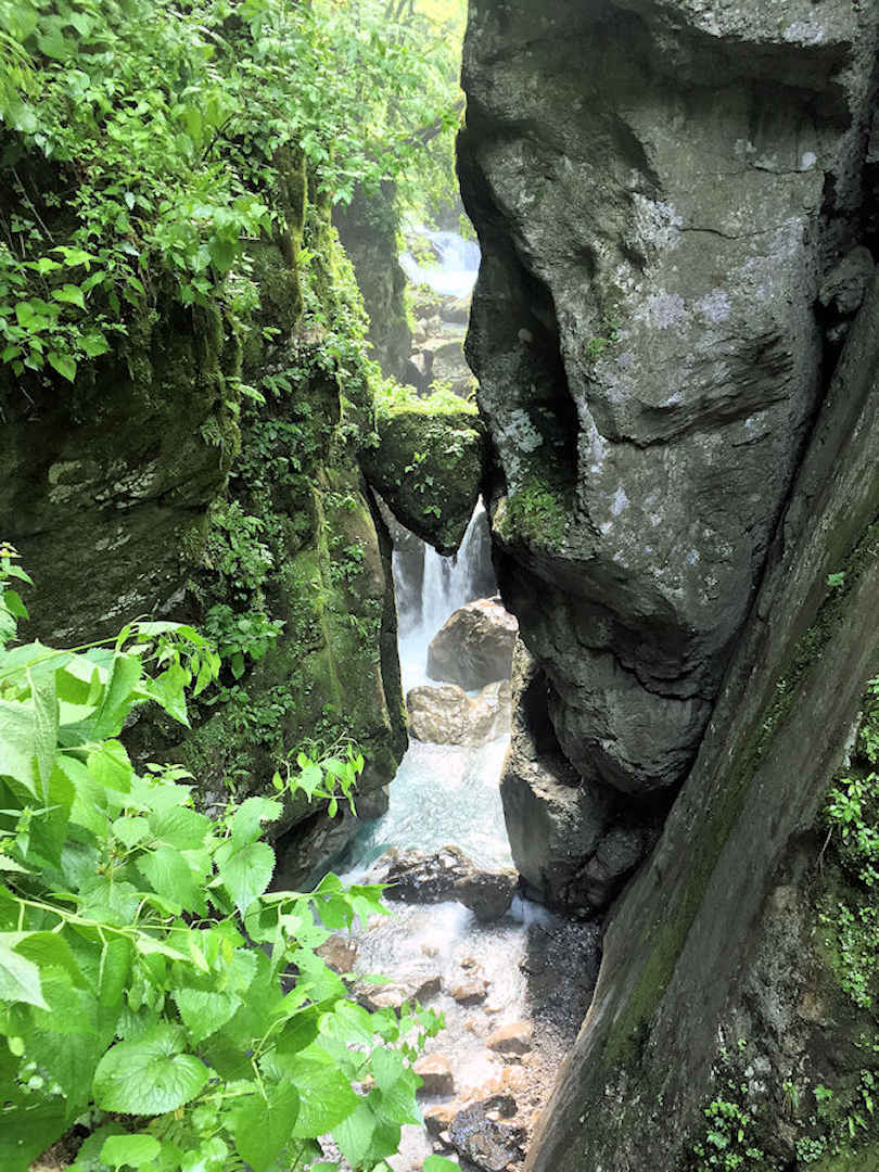
Wedged into the gorge of the Zadlaščica river, this mossy rock is called Bear's Head
Tolmin is a short 20-minute drive (or bus ride) southeast of Kobarid. If you come by car there are several parking lots: a paid parking lot right by the entrance and a second parking lot (free of charge) approximately 15 minutes walk (or shuttle bus ride) away from the entrance [Google Maps location].
If you don’t have your own transport: You can take the shuttle bus from the bus stop in Tolmin’s centre to the entrance of the Tolmin Gorges. Alternatively, it’s an easy 2-kilometre / 30-minute walk along the Tolminka river.
There is a trail leading through the Tolmin Gorges, and you’ll be given a map at the entrance to guide you.
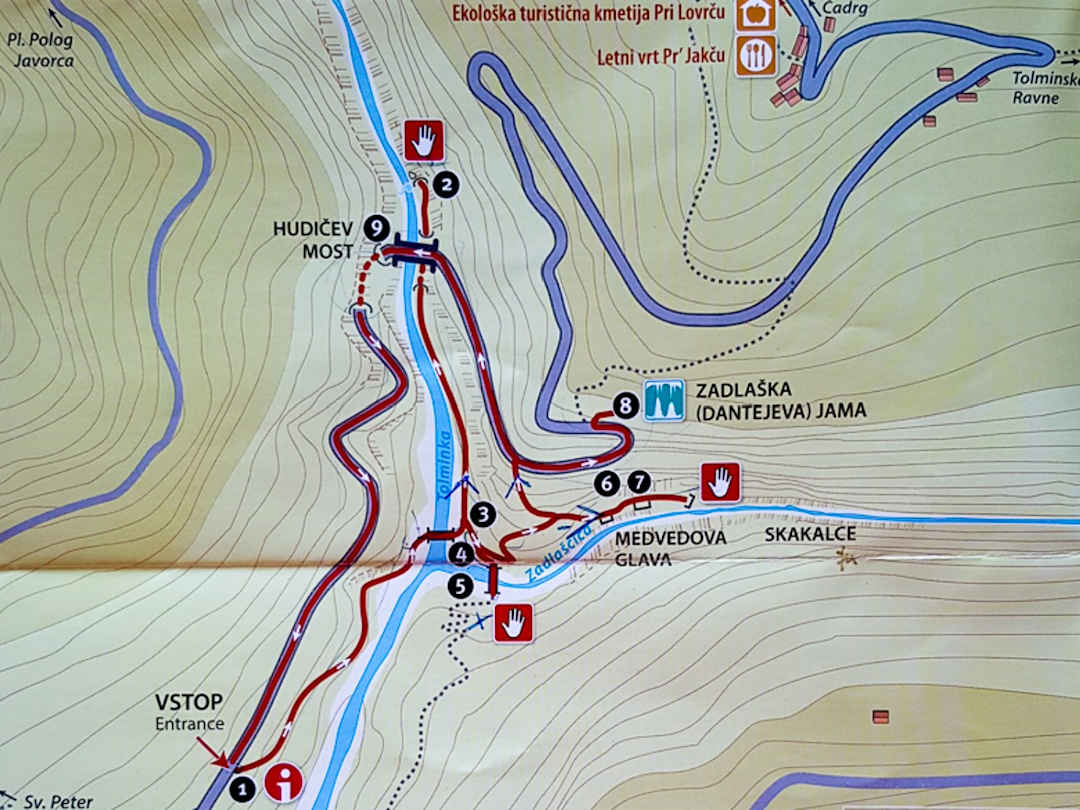
A map like this leads you through the Tolmin Gorges in an anti-clockwise direction
My favourite parts were the deep and narrow Tolminka Gorge with its thermal spring – number 2 on the map (the water was low enough for me to see it) and Devil’s Bridge high above, as well as Bear’s Head (a large mossy rock wedged into the narrow gorge of the Zadlaščica River) – number 7 on the map.
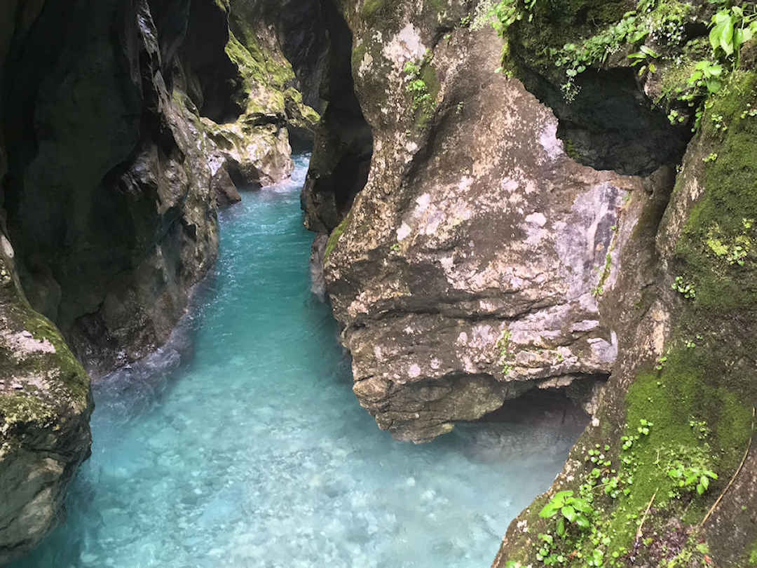
The water in the Tolminka Gorge was low enough for me to see the thermal spring. You can make out the beige deposits at the bottom right.
The two kilometre loop around the two gorges, Dante’s Cave and across Devil’s Bridge takes 90 minutes – more if you share the narrow trail with heaps of people or stop frequently to take pictures.

The deep and narrow Tolminka Gorge with the Devil’s Bridge high above was one of my favourites

f you can, visit the Tolmin Gorges first thing in the morning. I had them all to myself for the first 30 minutes.
The drive back to Ljubljana (city or airport) takes about two hours. If you have time stop in Most na Soči along the way. Thanks to a nearby hydro-electric plant, the Soča river forms a lake here, creating a very picturesque setting for this quaint little town.
If you don’t have your own transport: We would recommend to stay a second night in Kobarid and visit the Tolmin Gorges in the morning, as buses to Ljubljana from Tolmin are thinning out in the afternoon. Alternatively, you could take a taxi or hitchhike from Tolmin to Most na Soči (5 kilometres south) and take the train back to Ljubljana from there.
Where to stay when exploring the Julian Alps and Soča Valley?
If you have your own transport, you can stay anywhere along the valley. However, if you use public transport, we recommend staying in Bovec and/or Kobarid.
Bovec reminded us a bit of Queenstown in New Zealand. While it isn’t located on a big mountain lake, it’s the adventure capital of Slovenia. If you’re an adrenaline junkie you can knock yourself out, literally. Rafting, canyoning, kayaking, paragliding, skydiving, ziplining… you can do all of it in Bovec.
Kobarid has a more tranquil, relaxed feel. As one of the locals put it to us: you go to Bovec for the action and Kobarid for the culture. Well, we visited both and can only recommend it.
| Name | Property Features | Location | Type | Price Indicator | Book Now |
|---|---|---|---|---|---|
| Back Hostel | Bunk bed in dormitory (for four) Shared bathroom and kitchen | Bled | Hostel | $ | Book Now |
| Castle Rock Bled apartment | Certain documented environmental practices implemented at property. 300 metres from Bled Castle. | Bled | Apartmenr | $$ | Book Now |
| Quercus Apartments Bled | Certain documented environmental practices implemented at property. | Bled | Apartment | $$$ | Book Now |
| Viktoria Apartments | 550 metres from Lake Bled. | Bled | Apartment | $$$ | Book Now |
| Bovec Apartments Free Alps | One or two bedroom apartments Suburb Reviews | Bovec | Apartment | $$ | Book Now |
| Cozy Apartment Bovec | Certain documented environmental practices implemented at property Mountain and garden views | Bovec | Apartment | $$$ | Book Now |
| Hotel Mangart | 4-stars Restaurant Outdoor swimming pool Wellness and Spa Centre | Bovec | Hotel | $$$ | Book Now |
| Hotel Sanje ob Soci | 4-stars Certain documented environmental practices implemented at property. | Bovec | Hotel | $$$ | Book Now |
| City Nest Apartment | One bedroom Apartment Exceptional Reviews | Kobarid | Apartment | $$ | Book Now |
| Jelenov breg pod Matajurem | 2-stars Certain documented environmental practices implemented at property. Bar and family-friendly restaurant | Kobarid | Farm Stay | $$ | Book Now |
| Apartments Pri nas | 4-stars Certain documented environmental practices implemented at property. Outdoor hot tub Facilities for disabled guests | Kobarid | Apartment | $$$ | Book Now |
| Studio Brnat | Suburb Reviews | Kobarid | Studio | $$ | Book Now |
| Rooms Pri Lovrizu | 2-stars Certain documented environmental practices implemented at property. Shared lounge | Kobarid | Gursthouse | $$$ | Book Now |
| Hotel Slamic Ljubljana | Certain documented environmental practices implemented at property 3-stars Bar Breakfast | Ljubljana | B and B | $$$ | Book Now |
| Vila Selena | 3-stars Certain documented environmental practices implemented at property Super fast Wi-Fi | Ljubljana | Apartment | $$$ | Book Now |
| Oxford Apartments | On-site bar | Ljubljana | Apartment | $$$ | Book Now |
If you have visited the Julian Alps in Slovenia recently, what was your experience like? What other tips can you share?
I wrote this Julian Alps itinerary and guide based on my own experience. If you have explored the Julian Alps, what hikes and other experiences can you recommend? If you want to visit, what additional questions do you have about the Julian Alps?
Before you go, if you liked our article and found it helpful, we would appreciate it if you could share it with your friends and family via the Share buttons below. Even better: Leave a short review on Trustpilot or Google, which would help us further build our online reputation as a (trustworthy and helpful) travel and lifestyle blog.

