

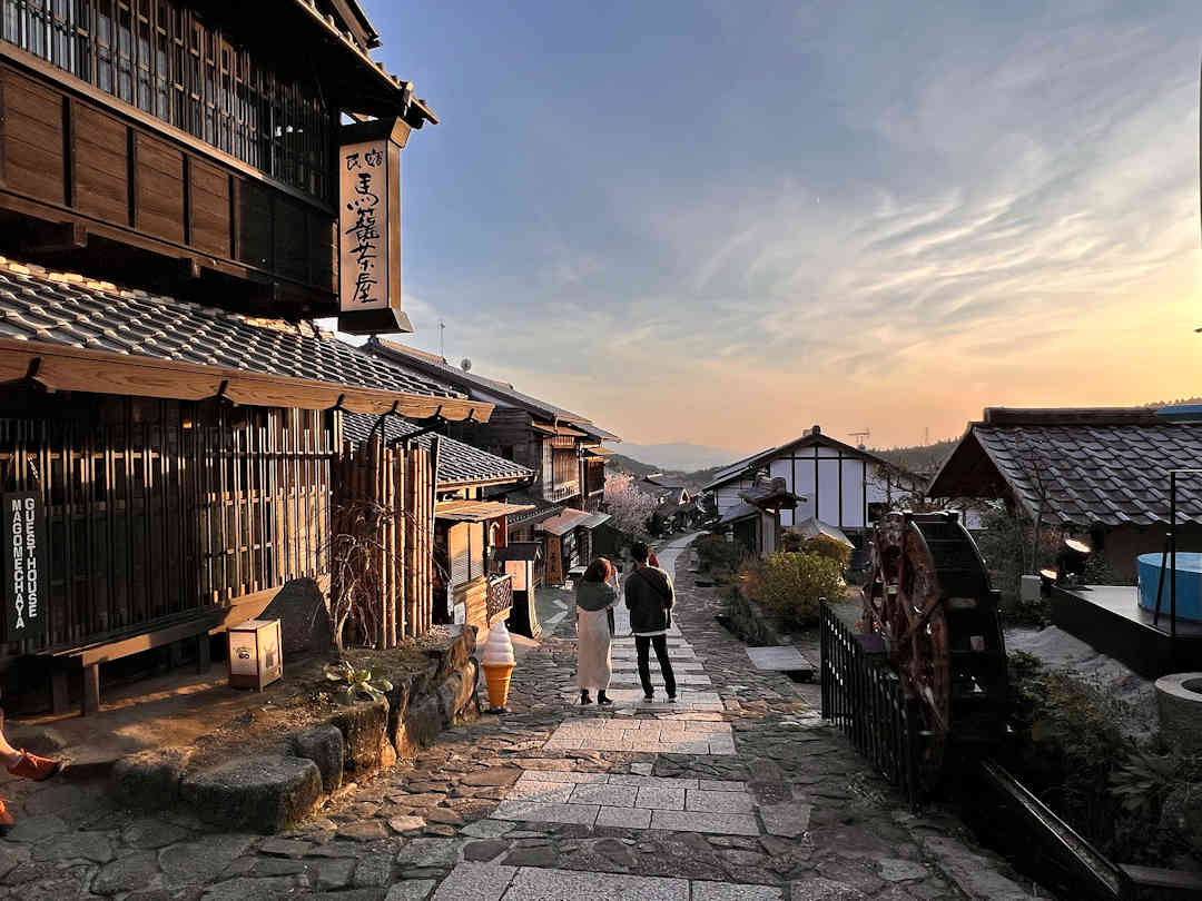
This article may contain links to products and services we use and recommend. We may receive compensation when you click on links to those products. For more information, see our Disclosure Policy.

Whether you’re a novice looking for a pleasant day hike or an expert seeking a more challenging multi-day hike, the Nakasendo offers a range of options to suit all interests and abilities. We have collated 1-, 2- and 3-day itineraries along the best-preserved segments of this historic postal route, allowing you to customise your hike with ease. All itinerary suggestions can (of course) also be done in reverse.
And if you’d like to know more about the Nakasendo, make sure to also check out our Nakasendo Hiking Guide, which answers questions such as:
- How to get to the Nakasendo and how to get around?
- Where to stay and how to book accommodation on the Nakasendo?
- What to eat and where along the Nakasendo?
- When is the best time and what to pack for your hike?
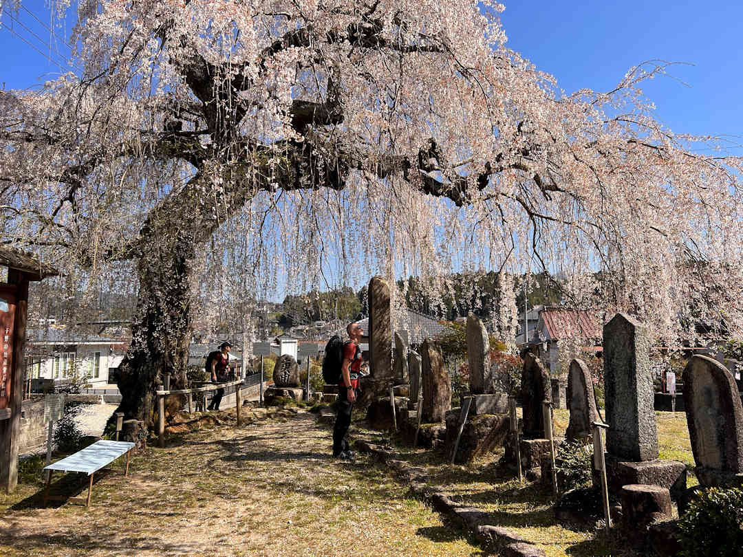
The Nakasendo spans over 530 kilometres but only the best preserved sections are recognized as National Historic Sites of Japan | Image courtesy of Jennie Ryken
Map of Accommodation, Points of Interest, Eateries and Transport
Below is a map of the recommended accommodations, points of interest, eateries, and transport terminals or stops mentioned in this article.
How best to hike the Nakasendo in a day?
Itinerary 1: Magome to Tsumago (with optional hike to Nagiso)
This itinerary (total distance: 6 kilometres / 4.1 miles with an elevation gain: 246 metres / 807 feet) covers the most popular route between the picturesque postal towns Magome [Google Maps location] and Tsumago [Google Maps location], with an optional hike from Tsumago to the Nagiso train station [Google Maps location] (total distance: 3.7 kilometres / 2.3 miles with an elevation gain of 112 metres / 367 feet).
- Travel by train to Nakatsugawa Train Station [Google Maps location] and from there by bus to Magome.
- Hike from Magome to Tsumago – 6 kilometres / 4.1 miles over 2 to 3 hours with an elevation gain of 246 metres / 807 feet.
- Optional: Hike Tsumago to Nagiso Train Station – 3.7 kilometres / 2.3 miles in one hour with an elevation gain of 112 metres / 367 feet (or take the bus).
- Return/continue your onward travel by train from Nagiso Train Station [Google Maps location].
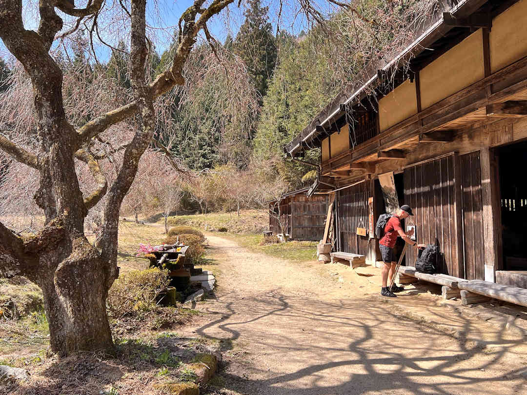
A tea house between Magome and Tsumago offers freshly brewed tea and lollies for tired travellers | Image courtesy of Jennie Ryken
Itinerary 2: Magome to Tsumago AND Yabuhara to Narai (via the Torii-toge Pass)
This itinerary (total distance: 14 kilometres / 8.7 miles with an elevation gain of 490 metres / 1607 feet) will take you to the three most picturesque postal towns Magome, Tsumago and Narai, and includes hiking over a more challenging mountain pass.
- Travel by train to Nakatsugawa Train Station [Google Maps location] and from there by bus to Magome [Google Maps location].
- Hike from Magome to Tsumago – 7 kilometres / 4.3 miles over 2 to 3 hours with an elevation gain of 170 metres / 558 metres.
- Continue by bus to Nagiso train station [Google Maps location] and from there by train to Yabuhara Train Station [Google Maps location].
- Hike from Yabuhara to Narai – 7 kilometres / 4.3 miles over 2 to 3 hours with an elevation gain of 320 metres / 1050 feet.
- Return/continue your onward travel by train from Narai Train Station [Google Maps location].
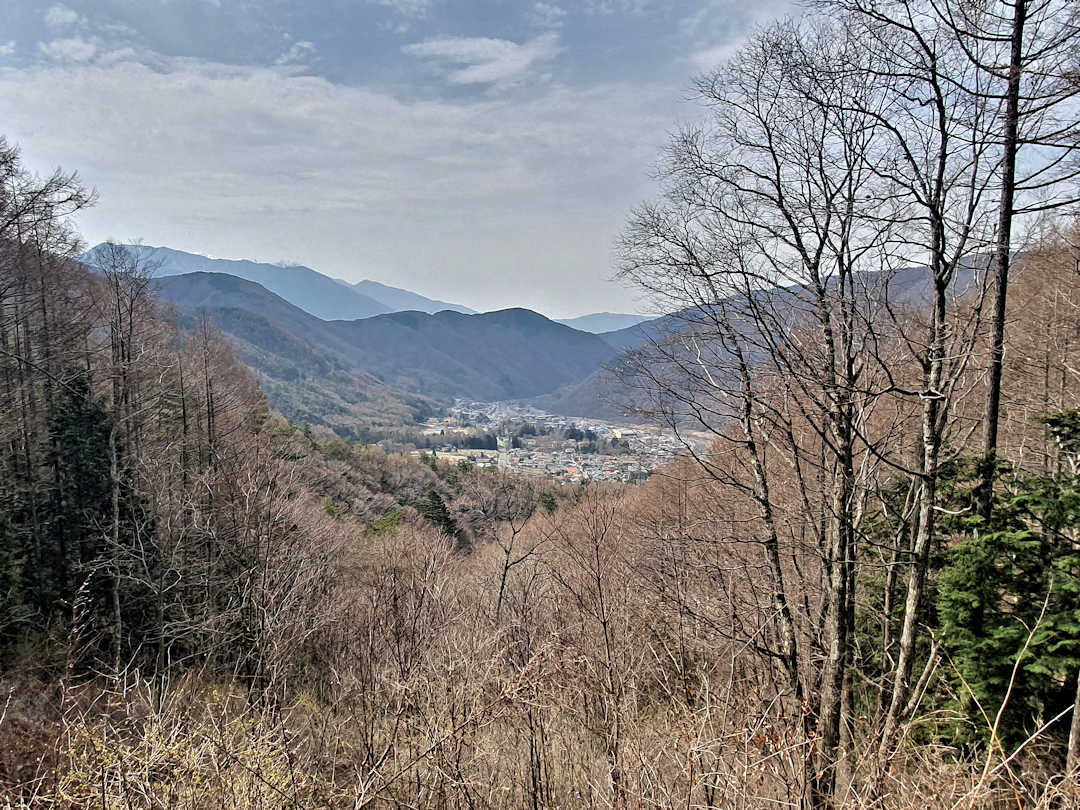
The hike from Yabuhara to Narai takes you over Torii-toge Pass - Enjoy the views of Narai in the distance and keep an eye out for Japanese macaques that roam the mountains
Itinerary 3: Nakatsugawa to Tsumago (via Magome) with an optional hike to Nagiso
This itinerary (total distance: 17 to 21 kilometres / 10.6 to 13.1 miles with an elevation gain of 550 to 640 metres / 1805 to 2100 feet) includes offbeat and well-preserved original sections of the Old Nakasendo as well as the picturesque postal towns Magome and Tsumago (with an optional hike from Tsumago to Nagiso train station).
- Travel by train to Nakatsugawa Train Station [Google Maps location].
- Hike from Nakatsugawa to Magome – 10 kilometres / 6.2 miles in 3 to 4 hours with an elevation gain of 380 metres / 1247 feet
- Have lunch in Magome.
- Hike from Magome to Tsumago – 7 kilometres / 4.3 miles in 2 to 3 hours with an elevation gain of 170 metres / 558 feet
- Optional: Hike from Tsumago to Nagiso Train Station [Google Maps location] – 4 kilometres / 2.5 miles in one hour with an elevation gain of 90 metres / 295 feet (or take the bus)
- Return/continue your onward travel by train from Nagiso Train Station.
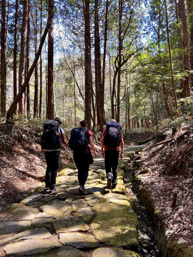
The Nakasendo section near Ochiai still contains the original cobble-stoned road
How best to hike the Nakasendo in two days?
Itinerary 1: Nakatsugawa to Nagiso (via Magome and Tsumago)
This itinerary (average daily distance: 10 kilometres / 6.2 miles with an average daily elevation gain of 320 metres / 1050 feet) includes offbeat and well-preserved original sections of the Old Nakasendo as well as the picturesque postal towns Magome and Tsumago (including the easy hike from Tsumago to the Nagiso Train Station).
Day 1
- Travel by train to the Nakatsugawa Train Station [Google Maps location].
- Hike from Nakatsugawa to Magome – 10 kilometres / 6.2 miles over 3 to 4 hours with an elevation gain of 380 metres / 1247 feet.
- Overnight in Magome. Check our recommended Nakasendo accommodations here.
Day 2
- Hike from Magome to Nagiso (via Tsumago) – 11 kilometres / 6.8 miles over 3 to 4 hours with an elevation gain of 260 metres / 853 feet
- Return/continue your onward travel by train from the Nagiso Train Station [Google Maps location].

A (now permanent) detour between Magome and Tsumago takes you past the Otaki/Metaki waterfalls
Itinerary 2: Nakatsugawa to Nagiso AND Yabuhara to Narai (via the Torii-toge Pass)
This itinerary (average daily distance: 12 kilometres / 7.5 miles with an average daily elevation gain of 440 metres / 1444 feet) takes you along offbeat and well-preserved original sections of the Old Nakasendo as well as the three most picturesque postal towns Magome, Tsumago and Narai (with an easy hike from Tsumago to Nagiso train station and a hike over a more challenging mountain pass).
Day 1
- Travel by train to Nakatsugawa Train Station [Google Maps location]
- Hike from Nakatsugawa to Magome – 10 kilometres / 6.2 miles in 3 to 4 hours with an elevation gain of 380 metres / 1247 feet
- Overnight in Magome. Check our recommended Nakasendo accommodations here.
Day 2
- Hike from Magome to Tsumago – 7 kilometres / 4.3 miles in 2 to 3 hours with an elevation gain of 170 metres / 558 feet
- Continue by bus to Nagiso Train Station and from there by train to Yabuhara Train Station [Google Maps location].
- Stop for lunch in Yabuhara.
- Hike from Yabuhara to Narai – 7 kilometres / 4.3 miles in 2 to 3 hours with an elevation gain of 320 metres / 1050 feet
- Return/continue your onward travel by train from Narai Train Station [Google Maps location].

Upon arrival in Tsumago, head to the bus stop near the parking lot for a ride to Nagiso
How best to hike the Nakasendo in three days?
Itinerary 1: Nakatsugawa to Nagiso AND Yabuhara to Kiso-Hirasawa
This itinerary (average daily distance of 10 kilometres / 6.2 miles with an average daily elevation gain of 380 metres / 1247 feet) includes offbeat and well-preserved original sections of the Old Nakasendo as well as four picturesque postal towns – Magome, Tsumago, Narai and Kiso-Hirasawa (with an easy hike from Tsumago to the train station in Nagiso and a walk over a more challenging mountain pass).
Day 1
- Travel by train to Nakatsugawa Train Station [Google Maps location].
- Hike from Nakatsugawa to Magome – 10 kilometres / 6.2 miles in 3 to 4 hours with an elevation gain of 380 metres / 1247 feet
- Overnight in Magome. Check out our recommended Nakasendo accommodations here.
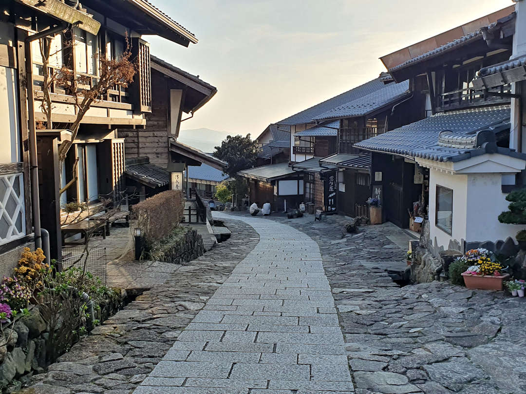
Staying overnight in Magome gives you the chance to experience it without the day visitor crowds
Day 2
- Hike from Magome to Nagiso (via Tsumago) – 11 kilometres / 6.8 miles in 3 to 4 hours with an elevation gain of 260 metres / 917 feet
- Travel by train to Kiso-Fukushima [Google Maps location] and overnight there. Check out our recommended Nakasendo accommodations here.
Day 3
- Travel by train to Yabuhara Train Station [Google Maps location].
- Hike from Yabuhara to Kiso-Hirasawa (via Torii-toge Pass and Narai) – 9 kilometres / 5.6 miles in 3 to 4 hours with an elevation gain of 340 metres / 1116 feet
- Return/continue your onward travel by train from Kiso-Hirasawa Train Station [Google Maps location].
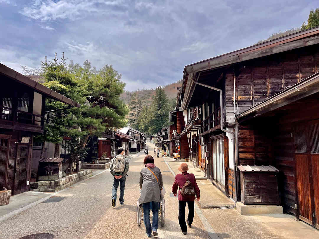
Narai and Kiso-Hirasawa are picturesque postal towns with old-style shops selling locally produced souvenirs
Itinerary 2: Nakatsugawa to Tsumago, Nagiso to Nojiri (via mountain path), Kakizore Gorge AND Yabuhara to Narai
This itinerary (average daily distance: 16 kilometres / 10 miles with an average daily elevation gain of 575 metres / 1886 feet) takes you along offbeat and well-preserved original sections of the Old Nakasendo, and gorgeous mountain and forest paths (including two more challenging mountain passes) to the most picturesque postal towns Magome, Tsumago and Narai.
It also includes a side trip to the emerald green waterfalls of the Kakizore Gorge (a beautiful spot not many visitors to the Nakasendo know about or make the effort to visit).
Day 1
- Travel by train to Nakatsugawa Train Station [Google Maps location]
- Hike from Nakatsugawa to Magome – 10 kilometres / 6.2 miles in 3 to 4 hours with an elevation gain of 380 metres / 1246 feet
- Take a break for lunch in Magome.
- Hike from Magome to Tsumago – 7 kilometres / 4.3 miles in 2 to 3 hours with an elevation gain of 170 metres / 558 feet
- Overnight in Tsumago. Check out our recommended Nakasendo accommodations here.
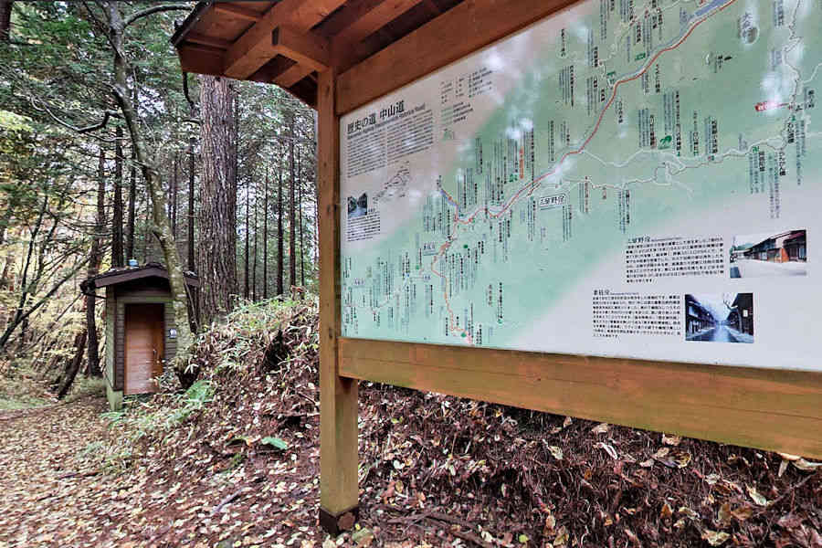
The hike from Nagiso to Nojiri via the Nenoue-toge Pass is an alternative Nakasendo route when the Kiso river valley is flooded
Day 2
- Optional: Hike from Tsumago to Nagiso Train Station [Google Maps location] – 4 kilometres / 2.5 miles of one-hour duration and an elevation of 90 metres / 295 feet (or take the bus)
- Hike from Nagiso to Nojiri (via Nenoue-toge Pass) – 15 kilometres / 9.3 miles in 5 to 6 hours with an elevation of 540 metres / 1772 feet
- Travel by train to Kiso-Fukushima [Google Maps location] and overnight there. Check out our recommended Nakasendo accommodations here.
Day 3
- Travel by train to Junikane Train Station [Google Maps location]
- Hike from Junikane to Nojiri (via Kakizore Gorge) – 9 kilometres / 5.6 miles of 3 to 4 hours with an elevation gain of 280 metres / 919 feet
- Travel by train from Nojiri Train Station [Google Maps location] to Yabuhara Train Station [Google Maps location]
- Hike from Yabuhara to Narai (via Torii-toge Pass) – 7 kilometres / 4.3 miles of 2 to 3 hours with an elevation gain of 320 metres / 1050 feet
- Return/continue your onward travel by train from Narai Train Station [Google Maps location].
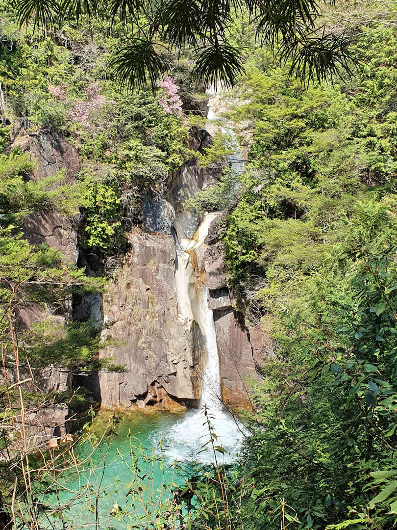
The hike from Junikane to Nojiri takes you along the crystal-clear waters of the Kakizore Gorge to beautiful Ushigataki Waterfall
Have you hiked the Nakasendo?
What was your experience? And if you are planning to hike the Nakasendo: What other questions have you got (that I haven’t answered here or in our hiking guide)?
Before you go, if you liked our article and found it helpful, we would appreciate it if you could share it with your friends and family via the Share buttons below. Even better: Leave a short review on Trustpilot or Google, which would help us further build our online reputation as a (trustworthy and helpful) travel and lifestyle blog.