

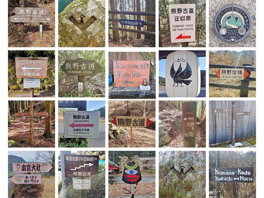
This article may contain links to products and services we use and recommend. We may receive compensation when you click on links to those products. For more information, see our Disclosure Policy.

Are you keen to hike the ancient pilgrimage trails of the Kumano Kodo? Why not follow the emperors and other members of the Japanese nobility and choose the Nakahechi route (also known as the Imperial Route)? Whether you have five days (or more) or only two, are a beginner or seasoned expert, our self-guided itineraries will help you create your perfect hiking adventure in the Kii Mountains of Japan.
Why choose the Nakahechi route?
The Nakahechi route is one of six remaining pilgrimage routes on the Kumano Kodo:
While more popular than some of the other Kumano Kodo routes, it is by no means a busy route (those having experienced the final 50 kilometres of the Camino de Santiago know what I mean by busy). The advantage of being more frequented is that you can stay in traditional Japanese inns along the way (with advance booking) rather than in your tent or a basic mountain shelter, and you don’t have to carry food for more than a day at a time.
Of the six remaining Kumano Kodo routes, the Nakahechi is the only one that connects all three Grand Shrines, offering a unique cultural and spiritual experience.
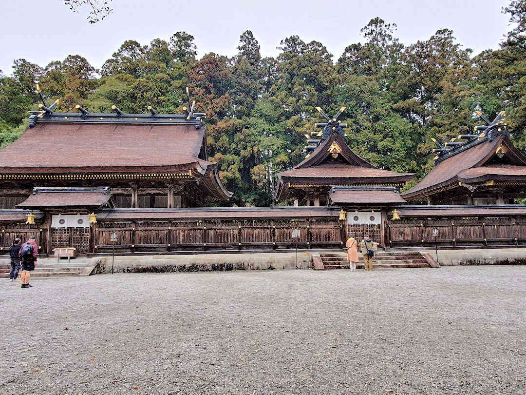
Kumano Hongu Taisha is one of three Grand Shrines, collectively called the Kumano Sanzan
Kumano Sanzan - the three Grand Shinto Shrines of the Kumano Kodo
Kumano Hongū Taisha
Kumano Hongū Taisha [Official website, Google Maps location] is located in the centre of the Kii Mountains, at the confluence of the Kumano and Otonashi Rivers. Its original entrance is marked by the world's largest shrine gate (called Torii) - the Ōyu no hara Torii - which is 34 metres high and 42 metres wide. Having been destroyed by floods (and rebuilt) a few times in its history, Kumano Hongū Taisha was relocated from its original site along the Kumano River to higher ground nearby in 1889. Among others, Kumano Hongū Taisha enshrines Izanagi, the founding father deity of Japan.
Kumano Nachi Taisha
Kumano Nachi Taisha is the second Grand Shrine in the Kii Mountains [Official website, Google Maps location]. It's uniquely positioned on the side of a mountain high above the Nachi River and next to Nachi Falls - at 133 metres, Japan's tallest single-drop waterfall and the home of Hiryū Gongen, another important Shinto deity. Nachi-san (as the sacred complex is often called) is also home to Seiganto-ji, a Temple of the Tendai School of Buddhism, and a holy 850-year-old Camphor tree, which is said to grant wishes to worshippers who walk through its hollow trunk.
Kumano Hayatama Taisha
The third Grand Shinto Shrine, Kumano Hayatama Taisha [Official website, Google Maps location], is located on the east coast of the Kii Peninsula, in Shingū City near the mouth of the Kumano River. The Grand Shrine is home to a sacred 850-year-old Podocarp tree called Nagi no Ki. It is said that Izanagi and Izanami, the mythological couple that created Japan, first arrived in the area on a rock named Gotobiki Iwa. The rock marks the location of Kamikura-jinja, the original shrine, which pilgrims can reach by climbing a narrow 500-step stairway a few hundred meters south of the main complex.
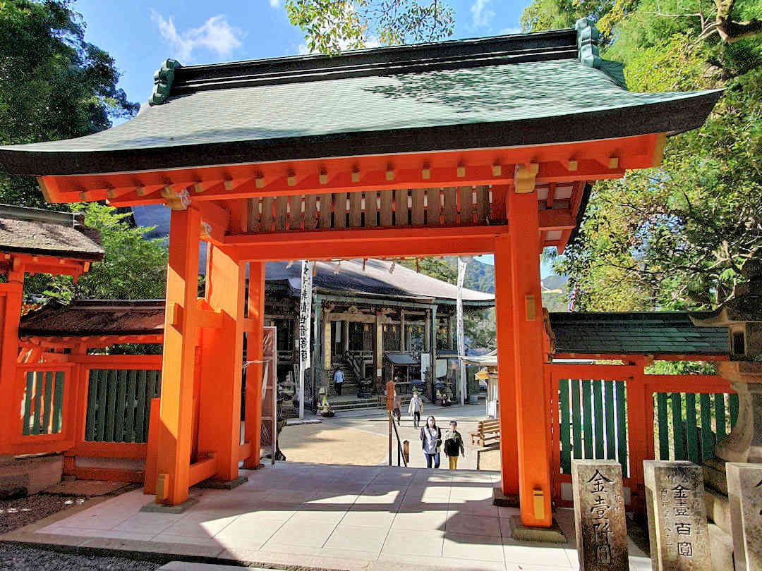
The UNESCO world heritage Kumano Kodo trails connect sacred Shinto and Buddhist sites
Another advantage of the Nakahechi route is flexibility – it’s the easiest to access of the three mountain routes. You can, therefore, hike the Nakahechi route
- as a point-to-point hike (changing your accommodation each night),
- base yourself in a central location and take buses to/from the starting/end points of each stage, or
- combine both (which we did over five days).
NOTE If you have walked (or are planning to walk) the Camino de Santiago and would like to be recognised as a Dual Pilgrim, only the Nakahechi and the Kohechi routes offer pilgrim passports (and stamps along the route) for your pilgrimage to be officially recognised.
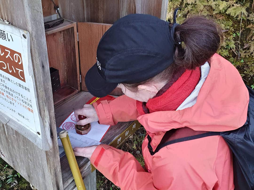
Collect stamps along the Kumano Kodo if you want to have your pilgrimage (officially) recognised
Where to stay on the Kumano Kodo – Nakahechi Route
For accommodation, it pays to shop around and compare like with like. When we book, we check several platforms to find the option that offers the best overall value, and we also look closely at what is and isn't included. Tourist taxes, cleaning fees, breakfast, cancellation terms, and payment timing can vary, so always read the fine print before you book.
If you want to see which booking platforms we use and why, visit our Accommodation Travel Resources. Below are our recommended places to stay, well-located for public transport and the main points of interest.
| Name | Property Features | Location | Price Indicator | Book Now |
|---|---|---|---|---|
| Minshuku Nakano | Traditional tatami rooms Shared kitchen and lounge Japanese-style dining room with irori hearth | Chikatsuyu | $$ | Book Now |
| Minshuku Momiji-no-Sato | Private rental house Dinner, breakfast and lunch box available Directly on the Kumano Kodo route | Chikatsuyu | $$ | Book Now |
| Guest House Agae | Renovated traditional house Private stay for one group Close to bus stop, shops and restaurants | Chikatsuyu | $$ | Book Now |
| Guesthouse Okagesan | Historic house in Wataze Onsen Kitchen, laundry and free parking About 10 minutes’ walk to Watarase Onsen | Hongu | $$ | Book Now |
| Guesthouse Yui | Traditional tatami-style guesthouse Shared kitchen, laundry and free parking Good base for the Kumano Kodo and Hongu area | Hongu | $$ | Book Now |
| Chochu Stay So House | Whole-house stay with kitchen Garden, terrace and free parking Near Kii-Katsuura in Nachikatsuura | Kii-Katsuura | $$ | Book Now |
| Minpaku Kodo | Family home turned guesthouse Full kitchen and budget-friendly stay About 5 minutes from Daimon-zaka entrance | Kii-Katsuura | $$ | Book Now |
| WhyKumano | Opposite Kii-Katsuura Station Shared kitchen, lounge and bar Private rooms and dorm beds available | Kii-Katsuura | $$ | Book Now |
| Guest Cafe Kuchikumano | 1-star guesthouse with 5-star service. Highly recommended as a great starting accommodation for your pilgrimage. Japanese-style rooms with tatami floors Rooftop terrace, café and laundry Quiet base near Tanabe and the Kumano area | Kii-Tanabe | $ | Book Now |
| Guesthouse Takao | Tatami rooms with shared kitchenette Terrace and tea or coffee in shared area Walk to Tanabe’s shrines and station area | Kii-Tanabe | $$ | Book Now |
| Koguchi Shizen-no-Ie | Converted schoolhouse lodging Dinner, breakfast and lunch box available Key stop between the Ogumotori-goe and Kogumotori-goe | Koguchi | $$$ | Book Now |
| @ Koguchi | Japanese-style rooms with futons Dinner, breakfast and lunch box available Ensuite toilet but no bath in room | Koguchi | $$ | Book Now |
| Minshuku Momofuku | Run by Mr. Nakazawa, a friendly retiree. This tiny guesthouse has only two rooms. | Koguchi | $$ | Book Now |
| Guesthouse Yuzu | Cosy guesthouse with air-con, garden, terrace, free WiFi, shared kitchen, lounge, free bikes, and parking just outside the Kumano Hayatama Taisha grounds | Shingu | $$ | Book Now |
| Kokoyui Guesthouse Shingu | Whole-house stay with full kitchen Washing machine and free parking Walk to Kamikura Shrine and central Shingu | Shingu | $$ | Book Now |
| Shingu Guest House | 16-minute walk from Kumano Hayatama Taisha Shared lounge and kitchen | Shingu | $$ | Book Now |
| J-Hoppers Kumano Guesthouse | Private indoor and outdoor onsen baths Full kitchen and laundry facilities Right on the Kumano Kodo in Yunomine Onsen | Yunomine Onsen | $$ | Book Now |
How long does it take to hike the Nakahechi route?
There are three (recognised) pilgrimage options on the Nakahechi route:
- Takijiri-oji [Google Maps location] to Kumano Hongu Taisha, a hike of about 38 kilometres.
- Kumano Nachi Taisha to Kumano Hongu Taisha (or reverse) – an approximately 30 kilometres hike; and
- Hosshinmon-oji [Google Maps location] to Kumano Hongu Taisha (an easy hike of around 8 kilometres) PLUS a visit to Kumano Hayatama Taisha AND Kumano Nachi Taisha (the latter two can be done by any means).
Option 3 can be completed in two days, even by people who consider themselves unfit. However, you need five to six days and a basic fitness level to hike the complete Nakahechi route (options 1 and 2 plus a visit to Kumano Hayatama Taisha).
That said, when thinking about whether to include the Kumano Kodo in your Japan itinerary (or leave it for another time), do consider the following: The Kumano Kodo is not just about spending time in the beautiful mountains and forests of the Kii Peninsula. Like the Camino de Santiago, it’s a spiritual journey – the longer you hike it, the more impactful it is. While not difficult to reach, the Kumano Kodo takes a few hours to get to from Osaka or Nagoya. We therefore recommend budgeting at least four to five days for the Kumano Kodo – the longer, the better.
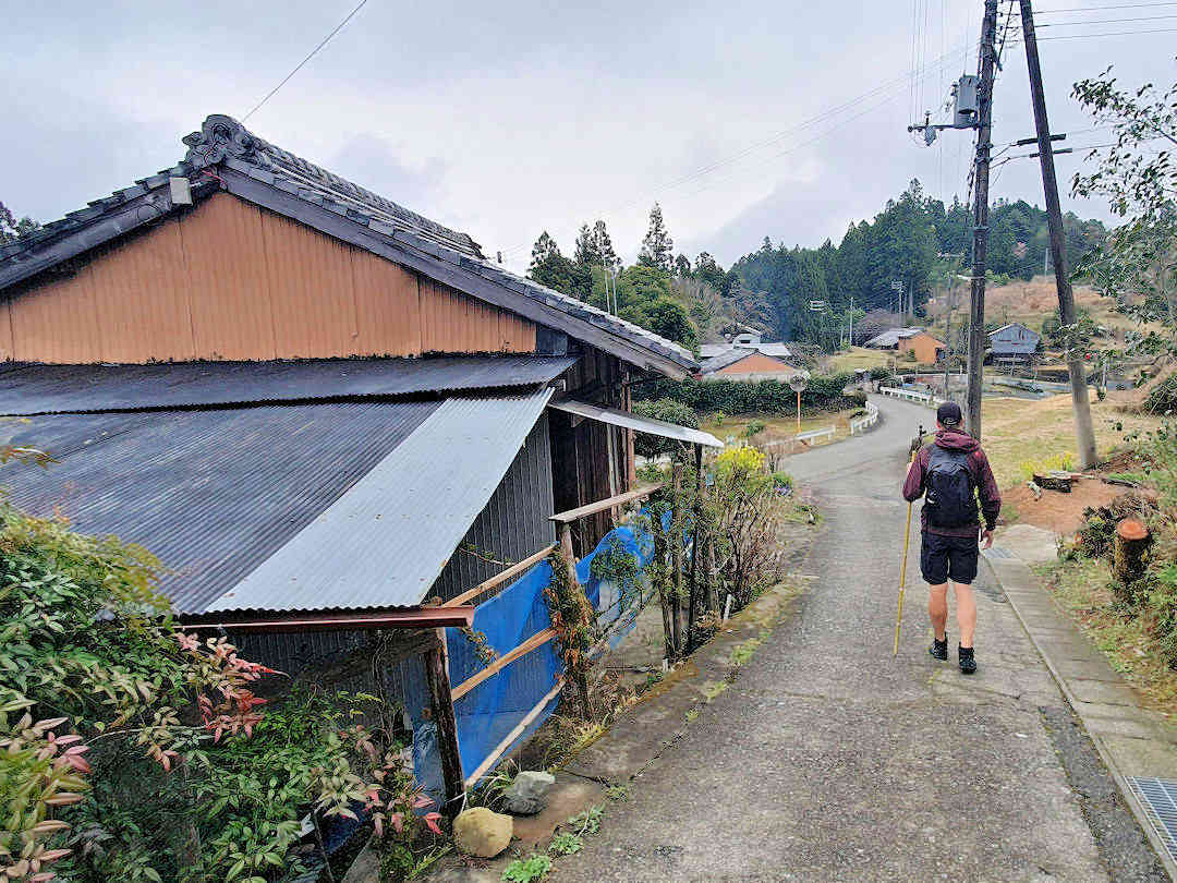
The Kumano Kodo is a spiritual journey – the longer you hike it, the more impactful it will be
You can hike the Nakahechi route point-to-point (changing your accommodation each night). Alternatively, you can base yourself in a central spot and take buses to/from the starting/end points of each stage. We provide various sample itineraries for each option below.
Hiking the Nakahechi point to point
2-Day Sample Itinerary: Hosshinmon-oji to Hongū hike (8 kilometres) PLUS Kumano Hayatama Taisha and Nachi-san
This itinerary includes a hike from Hosshinmon-oji [Google Maps location] to Kumano Hongu Taisha (approximately eight kilometres), PLUS a visit to Kumano Hayatama Taisha (by pilgrimage boat) AND Kumano Nachi Taisha (option 3 of the recognised pilgrimage routes).
Day 0
Travel to the Hongū area and stay the night. If you remain in Hongū, enjoy the medicinal hot spring waters at the Public Bath (Sosei-no-yu) [Google Maps location]. If you stay in Yunomine Onsen:
- Head to the public onsen [Official website, Google Maps location] (or use the private onsen in your accommodation).
- Boil some eggs and sweet potatoes in the public hot spring – best bought at Yumune Chaya [Google Maps location], the teahouse adjacent to the Yumune Kusushi Tōkō-ji Temple (squeezed between the river and the public onsen) – they make significant provisions for your hike.
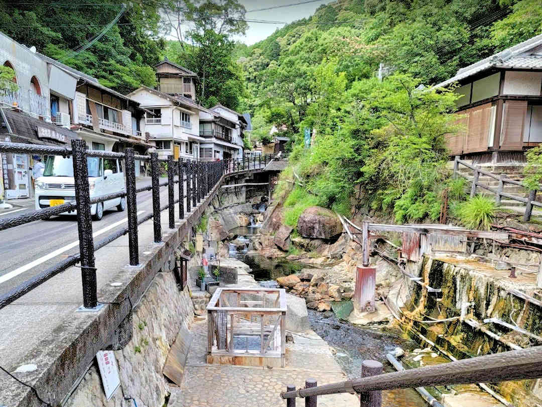
If you pass through Yunomine Onsen boil some eggs and sweet potatoes in the public hot spring - they make great provisions for your hike
Day 1
Get up early and take the bus to the Hosshinmon-oji bus stop [Google Maps location]. Hike from there first to Hosshinmon-oji (collect your first stamp) and then (largely downhill) to Kumano Hongu Taisha (approximately 8 kilometres).
If you have time, continue to the Oyu-no-hara Torii [Official website, Google Maps location] (about 1.5 kilometres away) for a complete experience. Download the Hosshinmon-oji to Kumano Hongū Taisha map and Hongū area map for offline use during your hike.
After lunch, take the bus (number 51) from Hongu Taisha-mae [Google Maps location] towards Shingū Station (latest at 13:25), get off at Michi-no-Eki Kumanogawa [Google Maps location] and join the riverboat at 14:30 (booking is essential). The riverboat tour takes 90 minutes, just enough time to visit Kumano Hayatama Taisha before it closes.
If you can’t get a reservation for the riverboat, don’t fret: the bus from Kumano Hongū Taisha to Kumano Hayatama Taisha takes approximately 60 minutes (number 51 to Shingū Station, latest at 14:45).
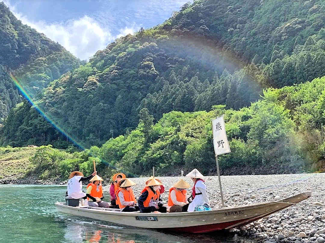
Taking the boat down the Kumano River to Kumano Hayatama Taisha is a unique experience on the Kumano Kodo
After exploring the Kumano Hayatama Taisha grounds, make sure to also visit Kamikura-jinja [Google Maps location]. This original shrine is on the rock named Gotobiki Iwa. It can be reached by climbing a 500-step stairway a few hundred meters south of the main complex, and it makes for a great sunset spot.
Stay overnight in Shingū. Refer to our recommended accommodation options above.
Day 2
After breakfast, take the train and bus to Nachi-san (approximately 90 minutes). Get off at the Daimonzaka bus stop [Google Maps location] and hike the Daimonzaka steps (~1.5 kilometres / 45-60 minutes) to Kumano Nachi Taisha.
Spend some time exploring the sacred grounds:
- Visit the Grand Shrine and the adjacent Seiganto-ji Temple [Google Maps location];
- Make a wish and walk through the cavity of the sacred 850-year-old camphor tree (Shorei-sha Shrine Tainai-Kuguri) [Google Maps location] and
- Walk to the three-storied pagoda (or further to Hirō-jinja [Google Maps location] and admire Nachi Falls.
After lunch, continue your onward journey.
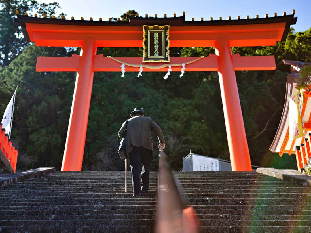
A steep climb up the Daimonzaka Steps takes you to the sacred sites of Nachi-san | Photo by Antonio Rull on Unsplash
3-Day Sample Itinerary: Hongū to Nachi-san hike (30km) PLUS Kumano Hayatama Taisha
This itinerary includes a hike from Kumano Hongu Taisha to Kumano Nachi Taisha (approximately 30 kilometres—option 2 of the recognised pilgrimage routes) and a visit to Kumano Hayatama Taisha.
Day 0
Travel to the Hongū area. After check-in, visit Kumano Hongu Taisha and Oyu-no-hara Torii [Official website, Google Maps location].
Stay the night in the Hongū area. If you stay in Hongū, enjoy the medicinal hot spring waters at the Public Bath (Sosei-no-yu) [Google Maps location]. If you remain in Yunomine Onsen:
- Head to the public onsen [Official website, Google Maps location] (or use the private onsen in your accommodation).
- Boil some eggs and sweet potatoes in the public hot spring – best bought at Yumune Chaya [Google Maps location], the teahouse adjacent to the Yumune Kusushi Tōkō-ji Temple (squeezed between the river and the public onsen) – they make significant provisions for your hike.
Download the Hongū area map for offline use during your hike.
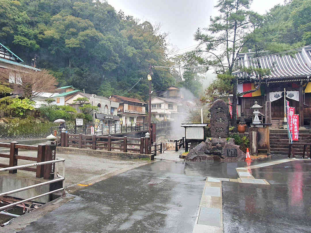
In Yunomine Onsen, buy eggs and sweet potatoes from Yumune Chaya, the tea house adjacent to the Yumune Kusushi Tōkō-ji Temple
Day 1
Today, you will hike the first stage to Kumano Nachi Taisha (also called Kogumotori-goe), which will take approximately 13 kilometres (5 hours).
Get up early and take the bus to the trailhead between the Ukegawa bus stop [Google Maps location] and the Shimoji-Bashi bus stop [Google Maps location]. If you haven’t stocked up on supplies, there is a convenience store [Google Maps location] at the Ukegawa bus stop. If you need to use the bathroom (there is only one other public toilet in today’s section, a 300-metre detour off the trail), there is one at the Shimoji-Bashi bus stop.
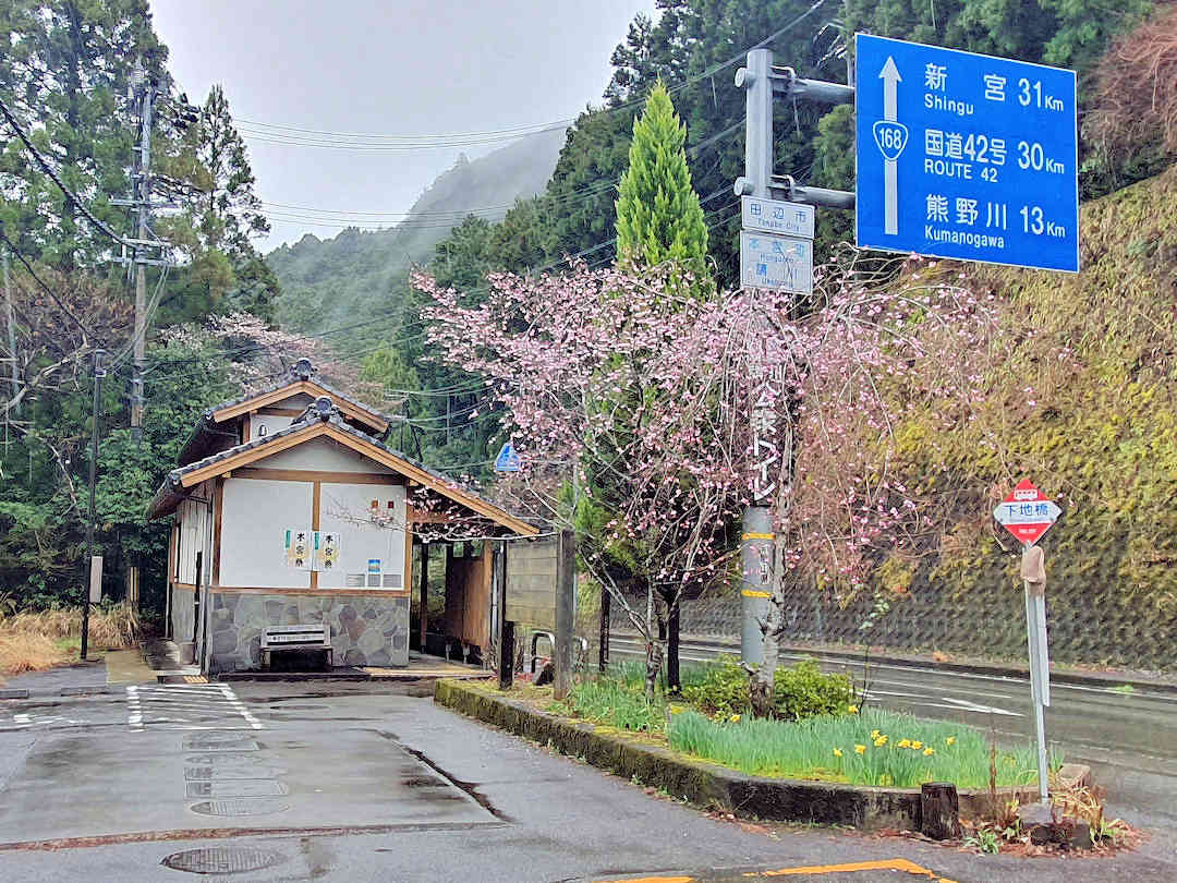
Use the public toilet at the Shimoji-bashi bus stop - there is only one other toilet along the Kogumotori-goe section of the Nakahechi
Today’s section takes you along (yet more undulating) forest trails, over a few passes (with lovely views on a clear day), past teahouse remains and several monuments, and ultimately on a long (and in parts slippery) descent into Koguchi.
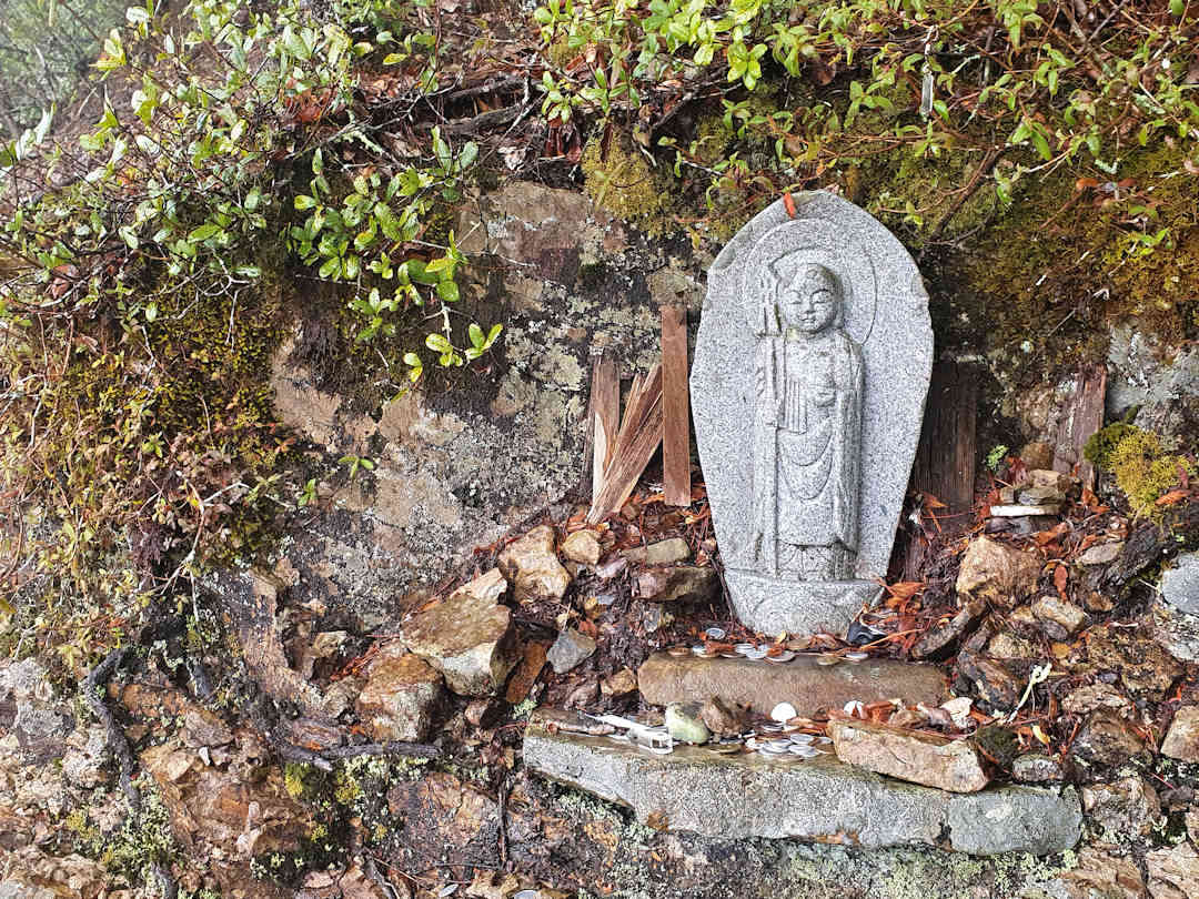
Praying and giving thanks at the little shrines and statues is a right of passage along the Kumano Kodo
As you reach Koguchi, cross over the bridge (there used to be a ferry here back in the day) and follow the signs along the river and over the road tunnel. As you descend from the tunnel, you walk past a cemetery on your left. Just keep walking straight (through what seem to be people’s backyards) until you reach the village road (you’ll see the main road and various bridges below you).
If you keep going straight along the village road, you’ll pass the post office (on the right, with an ATM) and a small grocery store [Google Maps location] (on your left, suitable for last-minute supplies).
Spend the night in Koguchi. Download the Kogumotori-goe (Ukegawa~Koguchi) map for offline use on your hike.
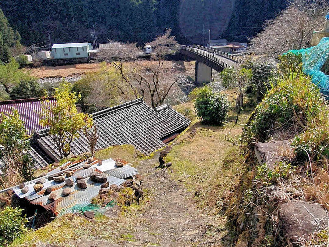
Upon completing the Kogumotori-goe section of the Nakahechi, crossing the Kowaze-bashi bridge will take you into Koguchi
Day 2
Today is the second stage of your hike to Kumano Nachi Taisha (also called Ogumotori-goe), which is approximately 16 kilometres / 5.5 hours.
Get up early and head to the trailhead (you can collect your next stamp there). Today’s hike crosses three mountain passes, with some very steep uphills and downhills. A shelter/rest stop is slightly off the trail at the top of the last pass. Make sure you stop there; you will be rewarded with beautiful panoramic views over the forests and mountains down to Kii-Katsuura and the Pacific Ocean.
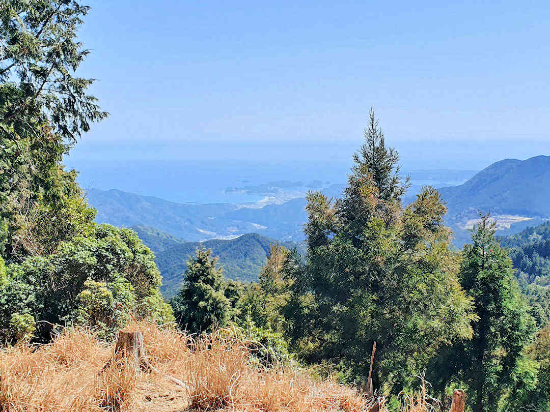
Stunning views from the rest stop near Funami-toge pass make the small detour off the Ogumotori-goe section of the Nakahechi worthwhile
After the rest stop, you slowly descend into Nachi-san, passing a big parking lot and through a recreational park. You finally exit the forest next to Seiganto-ji Temple [Google Maps location] – with a view of Nachi Falls and the three-storied pagoda.
Spend some time exploring the sacred grounds:
- Visit the Grand Shrine and the adjacent Seiganto-ji Temple [Google Maps location];
- Make a wish and walk through the cavity of the sacred 850-year-old camphor tree (Shorei-sha Shrine Tainai-Kuguri) [Google Maps location] and
- Walk to the three-storied pagoda (or further to Hirō-jinja [Google Maps location] and admire Nachi Falls.
Download the Koguchi-to-Nachi-san map for offline use during your hike.
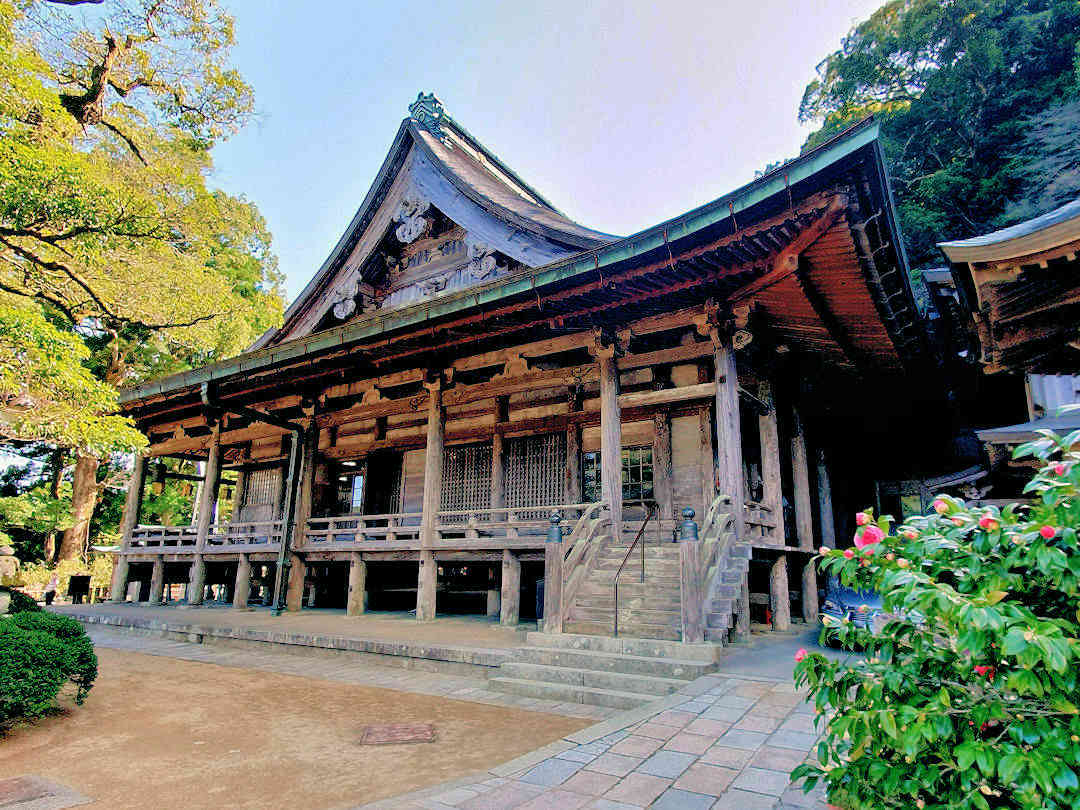
Beautiful Seiganto-ji Temple is one of the sacred Buddhist sites in Nachi-san
Day 3
After breakfast, take the bus and train to Kumano Hayatama Taisha (approximately 90 minutes from Nachi-san or just over 30 minutes from Kii-Katsuura).
After exploring the Kumano Hayatama Taisha grounds, make sure you also visit Kamikura-jinja [Google Maps location], the original shrine on the rock named Gotobiki Iwa. It is reached by climbing a 500-step stairway a few hundred meters south of the main complex.
After lunch, continue your onward journey.
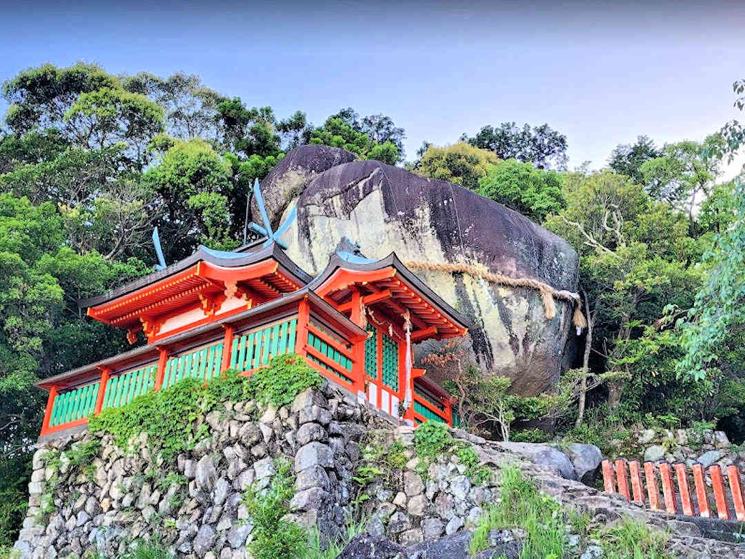
When visiting Kumano Hayatama Taisha don't forget to climb the 500 steps to Kamikura-jinja, the original shrine at Gotobiki Iwa
5-Day Sample Itinerary: The complete Nakahechi point-to-point
This itinerary includes the hike from Takijiri-oji [Google Maps location] to Kumano Hongu Taisha (approximately 38 kilometres – option 1 of the recognised pilgrimage routes) and the hike from there to Kumano Nachi Taisha (approximately 30 kilometres – option 2 of the recognised pilgrimage routes) PLUS a visit to Kumano Hayatama Taisha by bus/train.
Day 0
Travel to Kii-Tanabe [Google Maps location] or the surrounding villages and stay the night. Pop into
- the Tanabe Tourist Information Center [Google Maps location] to ask for a physical map of the Nakahechi route and
- a local supermarket or convenience store to buy provisions for the first stage of your hike.
Day 1
Get up early and take the bus to the Takijiri bus stop [Google Maps location] – you’d want to be there no later than 9:00.
Pop into the Kumano Kodo Information Center [Google Maps location] (in a round building across the river) for some last-minute advice and/or to use the bathroom. The Center also provides historical information on the Kumano Kodo for those who want to learn more. Don’t stay too long, though, as you’d like to get going – there is a long day ahead of you.
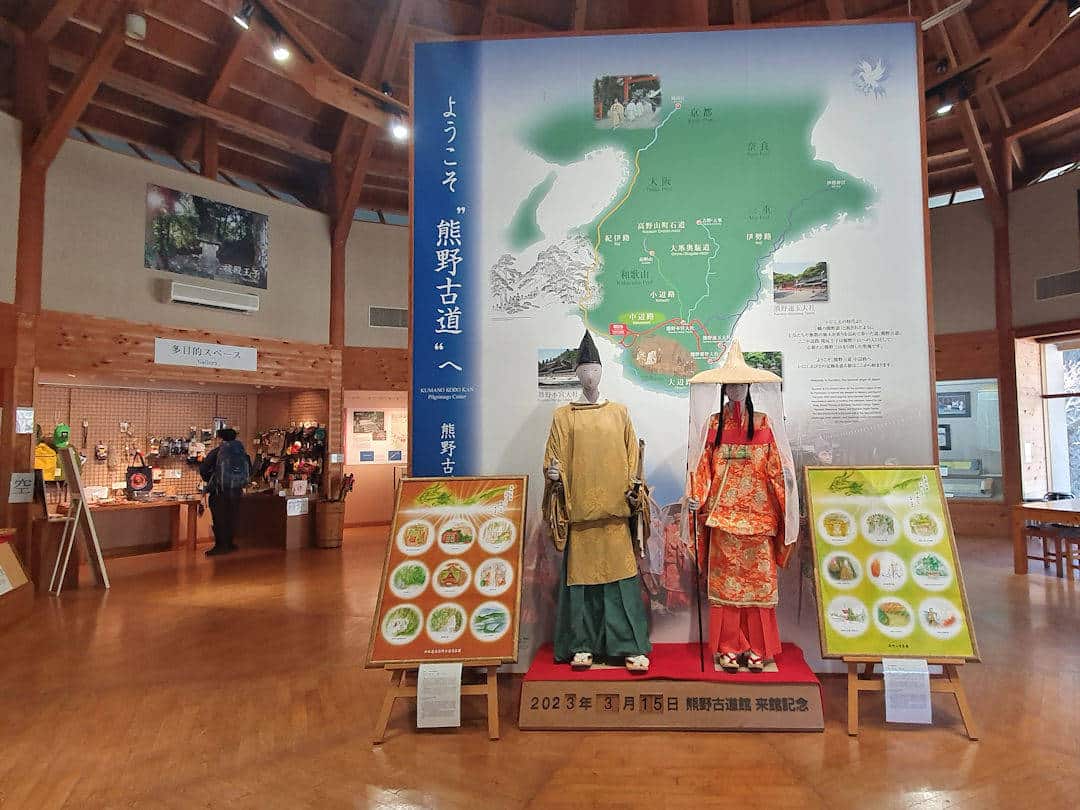
The Kumano Kodo Information Center in Takijiri provides historic information on the Kumano Kodo as well as last minute supplies and a public toilet
Takijiri-oji [Google Maps location], the starting point of the Nakahechi Route, is across the road from the Information Center. The trailhead is to the left behind the shrine. Today’s hike will take you from Takijiri-oji to Chikatsuyu or Nonaka (13-17 kilometres / 6-7.5 hours, depending on where you choose to stay for the night).
If you want your pilgrimage officially recognised, stop along the route to collect stamps for your pilgrim passport. Remember to collect your first stamp at Takijiri-oji. The wooden stand containing the stamp is in front of the little café to the left of the entrance to the shrine grounds.
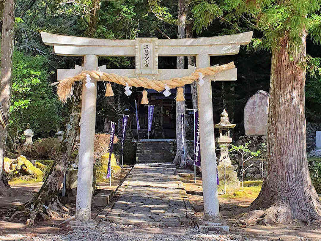
The trail head of the Kumano Kodo Nakahechi route is to the left behind Takijiri-oji
Today’s first stage of your hike is a steep climb, so take your time and watch your steps.
The first village you’ll pass through is Takahara. Takahara Kumano-jinja and (a bit further along) the public rest area overlooking the surrounding mountains are worthwhile places to stop. There is also a tiny family-run cafe called Coffee Keyaki [Google Maps location], which you’ll pass as you climb out of Takahara. It’s another worthwhile stop with gorgeous views over the mountains (and delicious coffee and pastries). Shortly after Takahara, you will pass the idyllic Takahara-Ike pond.
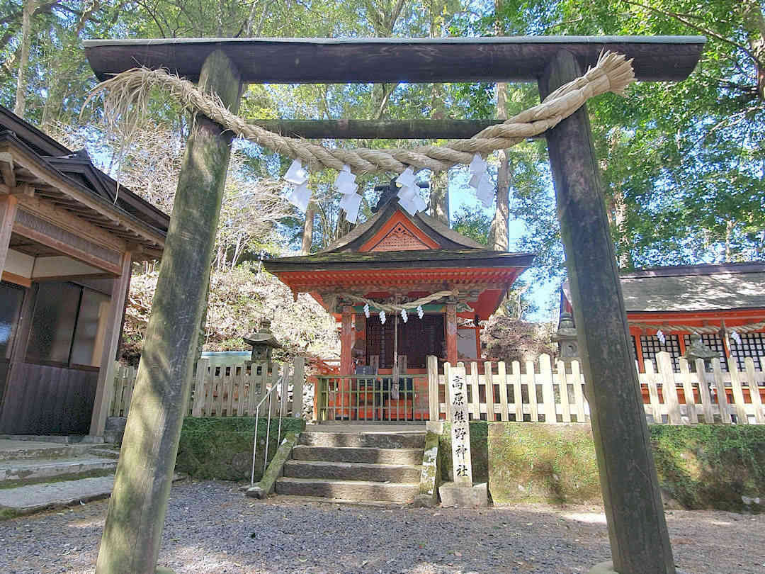
Takahara Kumano-jinja makes for a great rest stop after the steep climb from Takijiri-oji
Shortly before you reach Chikatsuyu, the trail briefly joins Highway 311, allowing you to use the public toilet and/or buy some food at the adjoining rest area before embarking on the day’s final stretch. This stretch takes you past the Gyuba-doji statue, a small statue showing Kazan, one of the first emperors to do the Kumano Kodo pilgrimage, sitting on a horse and cow.
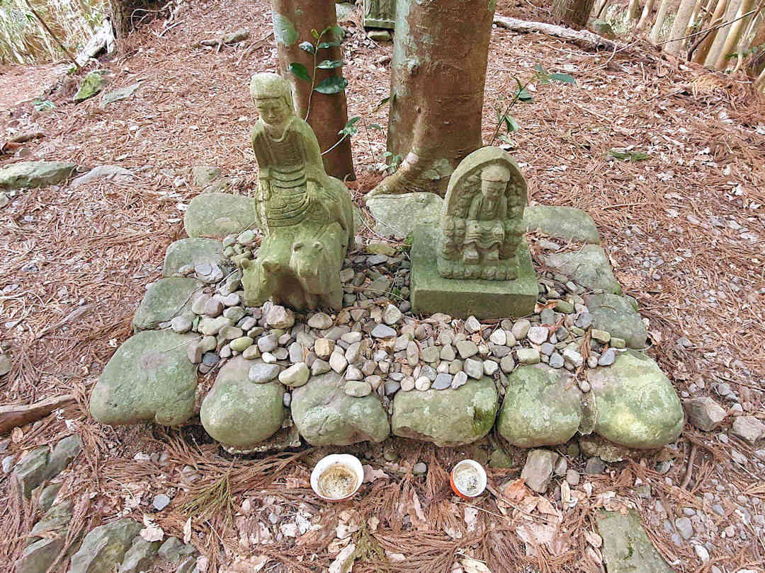
Shortly before Chikatsuyu, you will pass Gyuba-doji, a small statue showing Kazan, one of the first emperors to do the Kumano Kodo pilgrimage, sitting on a horse and cow
If your accommodation doesn’t provide dinner (or you chose not to book it), there are a few small cafes/restaurants in Chikatsuyu, though all close pretty early (we had a great meal at Tororoya restaurant [Google Maps location]). Also, pop into the local A Coop Supermarket [Google Maps location] in Chikatsuyu to buy provisions for the next day.
Stay overnight in one of the Japanese inns along/near the Kumano Kodo in Chikatsuyu or Nonaka (2-4 kilometres further along the route after Chikatsuyu).
Download the Takijiri-oji to the Takahara map and the Takahara to the Tsugizakura-oji map for offline use during your hike.
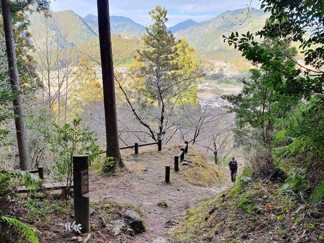
After passing the Gyuba-doji statue you slowly descend into Chikatsuyu
Day 2
Get up early and continue your hike along the Kumano Kodo. Today’s hike will take you to Kumano Hongu Taisha via Hosshinmon-oji (20-24 kilometres / 7.5-9 hours). While it is the longest of all your hiking days on the Kumano Kodo – Nakahechi Route, do make sure to stop at Tsugizakura-oji [Google Maps location]. The giant cedar trees are magnificent.
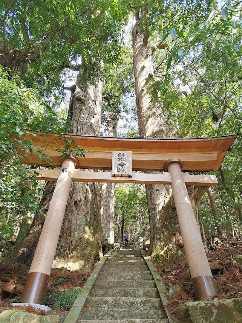
Make sure to stop at Tsugizakura-oji - the giant cedar trees are magnificient
Following Tsugizakura-oji, you climb, ultimately reaching Waraji-toge Pass, which makes for a nice rest stop.
You then descend and join a forest road along a valley stream. The original trail from here was severely damaged during a typhoon in 2011, necessitating a detour. You reach the detour further along the forest road, crossing a log bridge and climbing back into the mountains.
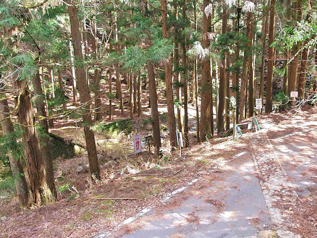
The original Nakahechi trail after the Waraji-toge Pass was badly damaged during a typhoon in 2011, requiring a detour to be put in place
After reaching the Detour Pass, the highest point of the day, the journey continues in (by now familiar) undulating fashion, following the Otonashi-gawa River, and passing Funatama-jinja [Google Maps location] and Inohana-oji [Google Maps location] before reaching Hosshinmon-oji [Google Maps location].
From Hosshinmon-oji, it’s an easy descent into Hongū. En route, you will pass the Sangen-jaya junction, where the Kohechi route joins the Nakahechi route. Shortly after, there is a slight (and worthwhile) detour to a viewpoint overlooking the Oyu-no-hara Torii [Official website, Google Maps location] in the valley below.
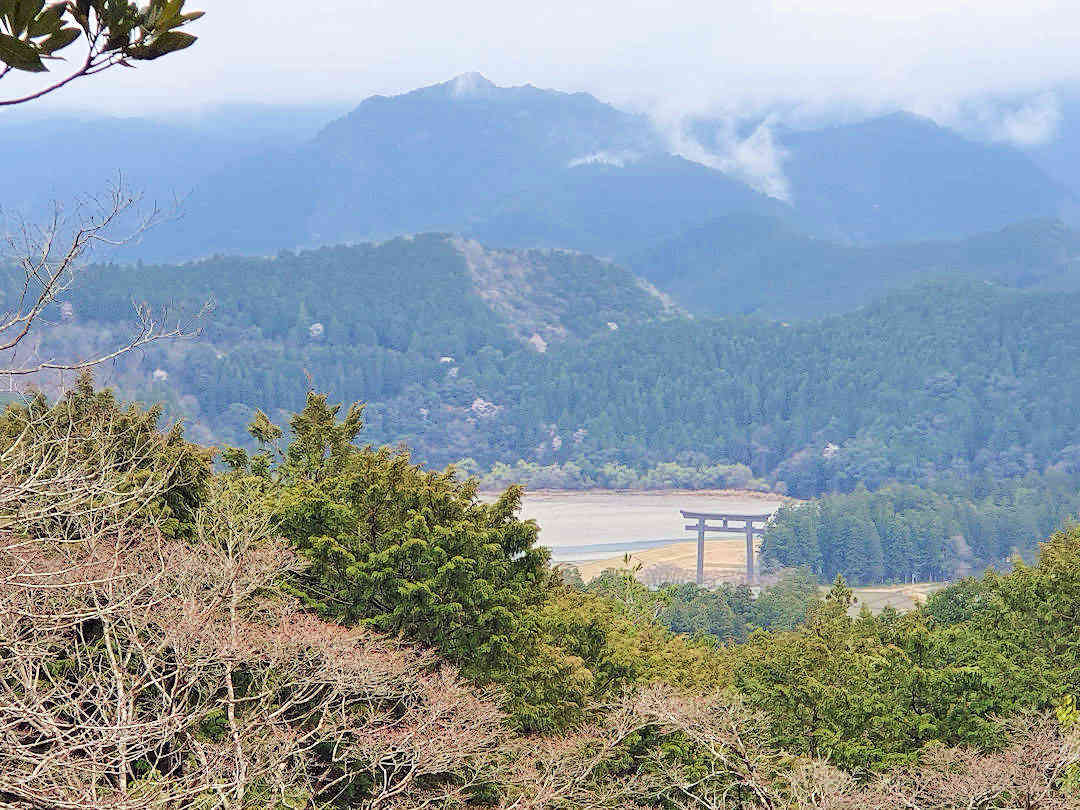
A small detour near the Sangen-jaya intersection provides a first glimpse of the Oyu-no-hara Torii Gate in Hongu
After visiting Kumano Hongu Taisha and Oyu-no-hara Torii, pop into the local convenience store to buy provisions for the next day. If your accommodation doesn’t provide dinner (or you chose not to book it), have dinner at one of the few local cafes/restaurants in Hongū.
Afterwards, head to your accommodation in the Hongū area. If you stay in Hongū, enjoy the medicinal hot spring waters at the Public Bath (Sosei-no-yu) [Google Maps location]. If you overnight in Yunomine Onsen:
- Head to the public onsen [Official website, Google Maps location] (or use the private onsen in your accommodation).
- Boil some eggs and sweet potatoes in the public hot spring – best bought at Yumune Chaya [Google Maps location], the teahouse adjacent to the Yumune Kusushi Tōkō-ji Temple (squeezed between the river and the public onsen) – they make significant provisions for your hike.
Download the Takahara to Tsugizakura-oji map, Tsugizakura-oji to Hosshinmon-oji map and Hosshinmon-oji to Kumano Hongū Taisha map to use offline during your hike.
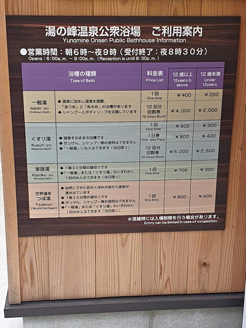
If you stay in Yunomine Onsen head to the public bath or use the private onsen in your accommodation
Day 3
Today, you do the first stage of the hike to Kumano Nachi Taisha (also called Kogumotori-goe, approximately 13 kilometres / 5 hours).
Get up early and take the bus to the trailhead between the Ukegawa bus stop [Google Maps location] and the Shimoji-Bashi bus stop [Google Maps location]. You can hike from Kumano Hongū Taisha to the trailhead (approximately 4 kilometres), but you’d just be following the road, so save your energy.
If you haven’t stocked up on supplies, there is a convenience store [Google Maps location] at the Ukegawa bus stop. If you need to use the bathroom (there is only one other public toilet in today’s section, with a 300-metre detour off the trail), there is one at the Shimoji-Bashi bus stop.
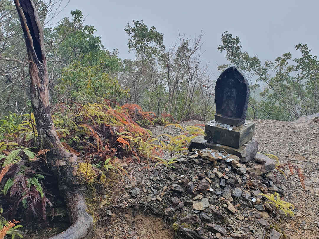
On a clear day, you can enjoy stunning views from Hyakken-gura on the Kogumotori-goe section of the Nakahechi
Today’s section takes you along (yet more undulating) forest trails, over a few passes (with lovely views on a clear day), past teahouse remains and several poet monuments, and ultimately on a long (and in parts slippery) descent into Koguchi.
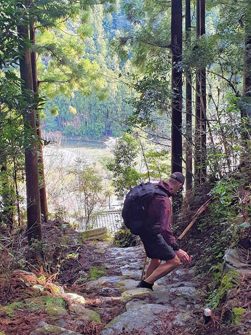
The descend into Koguchi is steep and slippery - take your time and watch your steps
As you reach Koguchi, cross over the bridge (there used to be a ferry here back in the day) and follow the signs along the river and over the road tunnel. As you descend from the tunnel, you walk past a cemetery on your left. Just keep walking straight (through what seem to be people’s backyards) until you reach the village road (you’ll see the main road and various bridges below you).
If you keep going straight along the village road, you’ll pass the post office (on the right, with an ATM) and a small grocery store [Google Maps location] (on your left, suitable for last-minute supplies).
Spend the night in Koguchi. Download the Kogumotori-goe (Ukegawa~Koguchi) map for offline use during your hike.
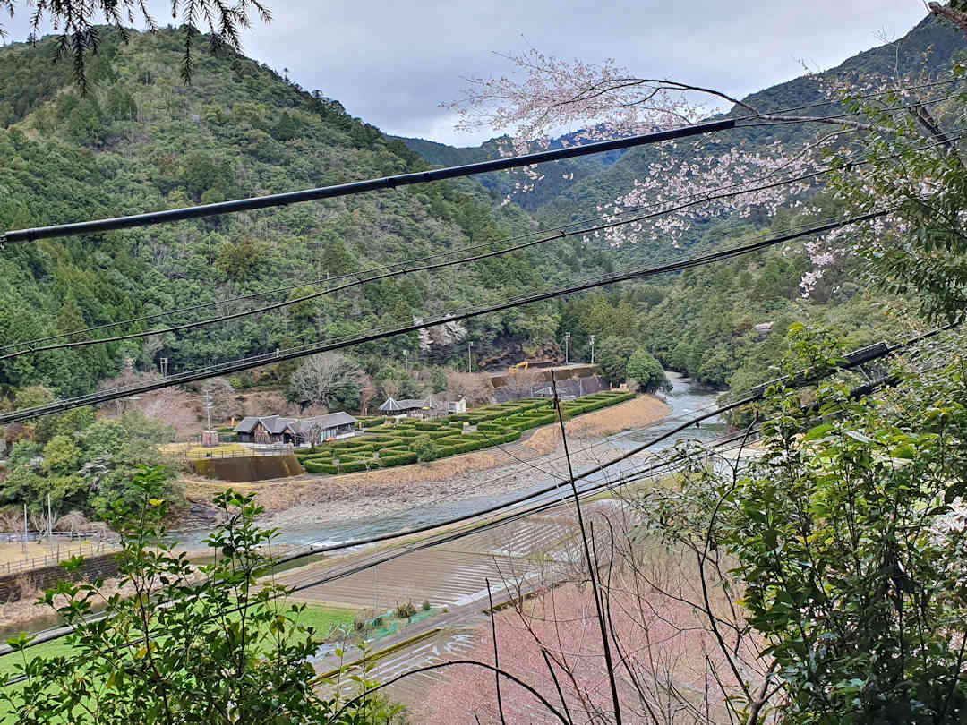
Koguchi is a small settlement at the confluence of the Akagi, Higashi and Wada rivers
Day 4
Today is the second stage of your hike to Kumano Nachi Taisha (also called Ogumotori-goe, approximately 16 kilometres / 5.5 hours).
Get up early and head to the trailhead (you can collect your next stamp there). Today’s hike includes three mountain passes with some very steep ups and downs. The rest stop is slightly off the trail at the top of the last pass. If you stop there, you will have beautiful panoramic views over the forests and mountains down to Kii-Katsuura and the Pacific Ocean.
After the rest stop, you slowly descend into Nachi-san, passing through a big parking lot and a recreational park. You finally exit the forest next to Seiganto-ji Temple [Google Maps location] – with a view of Nachi Falls and the three-storied pagoda.
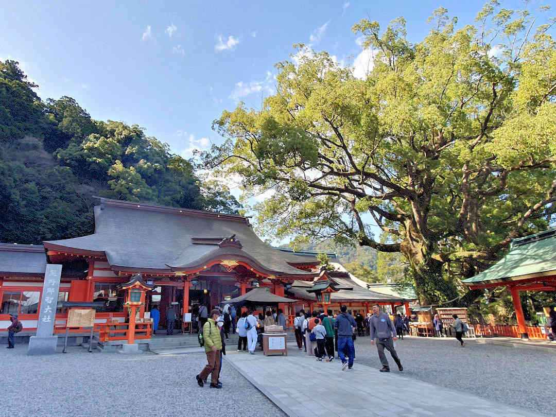
In Nachi-san, visit Kumano Nachi Taisha, the adjacent Seiganto-ji Temple and make a wish at the sacred 850-year-old camphor tree
Spend some time exploring the sacred grounds:
- Visit the Grand Shrine and the adjacent Seiganto-ji Temple [Google Maps location];
- Make a wish and walk through the cavity of the sacred 850-year-old camphor tree (Shorei-sha Shrine Tainai-Kuguri) [Google Maps location] and
- Walk to the three-storied pagoda (or further to Hirō-jinja [Google Maps location] and admire Nachi Falls.
Download the Koguchi-to-Nachi-san map for offline use during your hike.
Stay the night in Nachi-san or Kii-Katsuura. If the latter, make sure you don’t miss the last bus (usually around 18:00). Refer to our recommended accommodation options above.
Day 5
After breakfast, take the bus and train to Kumano Hayatama Taisha (approximately 90 minutes from Nachi-san or just over 30 minutes from Kii-Katsuura).
After exploring the Kumano Hayatama Taisha grounds, make sure you also visit Kamikura-jinja [Google Maps location], the original shrine on the rock named Gotobiki Iwa. It is reached by climbing a 500-step stairway a few hundred meters south of the main complex.
After lunch, continue your onward journey.
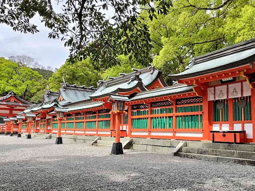
Located in the city of Shingu, Kumano Hayatama Taisha is the easiest to access but also the least crowded of the three Grand Shrines
Doing the Nakahechi route with day hikes from a central base
2(+1)-Day Sample Itinerary: The Nakahechi Main Route (38km) PLUS optional visit to Kumano Hayatama Taisha and Nachi-san
This itinerary includes a hike from Takijiri-oji to Kumano Hongu Taisha (approximately 38 kilometres – option one) PLUS a visit to Kumano Hayatama Taisha AND Kumano Nachi Taisha (option three of the recognised pilgrimage routes).
If this is your preference, we recommend basing yourself in Yunomine Onsen or Hongū.
Day 0
Travel to the Hongū area and stay the night. If you remain in Hongū, enjoy the medicinal hot spring waters at the Public Bath (Sosei-no-yu) [Google Maps location]. If you stay in Yunomine Onsen:
- Head to the public onsen [Official website, Google Maps location] (or use the private onsen in your accommodation).
- Boil some eggs and sweet potatoes in the public hot spring – best bought at Yumune Chaya [Google Maps location], the teahouse adjacent to the Yumune Kusushi Tōkō-ji Temple (squeezed between the river and the public onsen) – they make significant provisions for your hike.
Day 1
Get up early and take the bus to Takijiri-oji [Google Maps location] (1-1.5 hours). Hike to Chikatsuyu-oji [Google Maps location] (or better yet: Tsugizakura-oji [Google Maps location]). Then, take the bus back to Yunomine Onsen or Hongū (the last bus from Nonaka Ipposugi – the nearest bus stop to Tsugizakura-oji – is around 18:00).
Download the Takijiri-oji to the Takahara map and Takahara to the Tsugizakura-oji map for offline use during your hike.
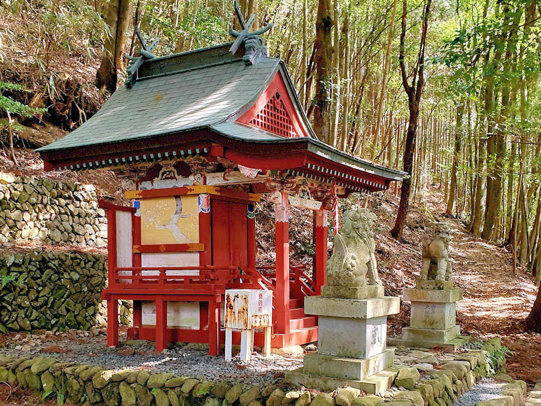
Tsugizakura-oji is a beautiful small shrine along the Kumano Kodo Nakahechi route
Day 2
Get up early and take the bus to Chikatsuyu or Nonaka Ipposugi (depending on where you finished yesterday/where you want to continue today). The bus takes 30 to 60 minutes.
Hike to Kumano Hongu Taisha via Hosshinmon-oji (20-24 kilometres / 7.5-9 hours).
Explore Kumano Hongu Taisha and Oyu-no-hara Torii. Then, return to your accommodation (the last bus from Hongū to Yunomine Onsen is around 19:00).
Download the Takahara to Tsugizakura-oji map, Tsugizakura-oji to Hosshinmon-oji map and Hosshinmon-oji to Kumano Hongū Taisha map to use offline during your hike.
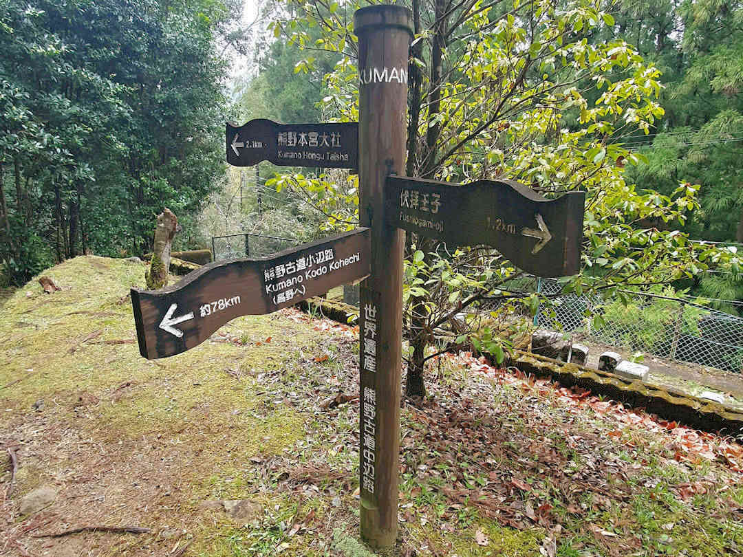
The hike from Hosshinmon-oji to Kumano Hongū Taisha will take you past the Sangen-jaya intersection where the Kohechi joins the Nakahechi route
(Optional) Day 3
After breakfast, check out and take the bus to Shingū Station. There, you can store your luggage in a coin locker.
Then, walk to Kumano Hayatama Taisha [Google Maps location] and spend the morning exploring the Shrine grounds. After exploring the Kumano Hayatama Taisha grounds, make sure you also visit Kamikura-jinja [Google Maps location], the original shrine on the rock named Gotobiki Iwa, which can be reached by climbing a 500-step stairway a few hundred meters south of the main complex.
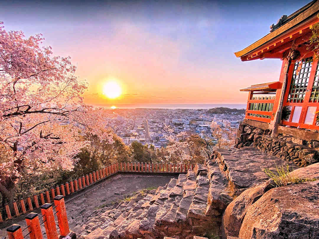
Kamikura-jinja, the original shrine at Gotobiki Iwa is especially beautiful at sunrise
Spend some time exploring the sacred grounds:
- Visit the Grand Shrine and the adjacent Seiganto-ji Temple;
- Make a wish and walk through the cavity of the sacred 850-year-old camphor tree and
- Walk to the three-storied pagoda (or further to Hirō-jinja) and admire Nachi Falls.
After your visit, return to Kii-Katsuura (the last bus is around 18:00) and stay for the night or continue your onward journey. If you stay overnight, refer to our recommended accommodation options above.
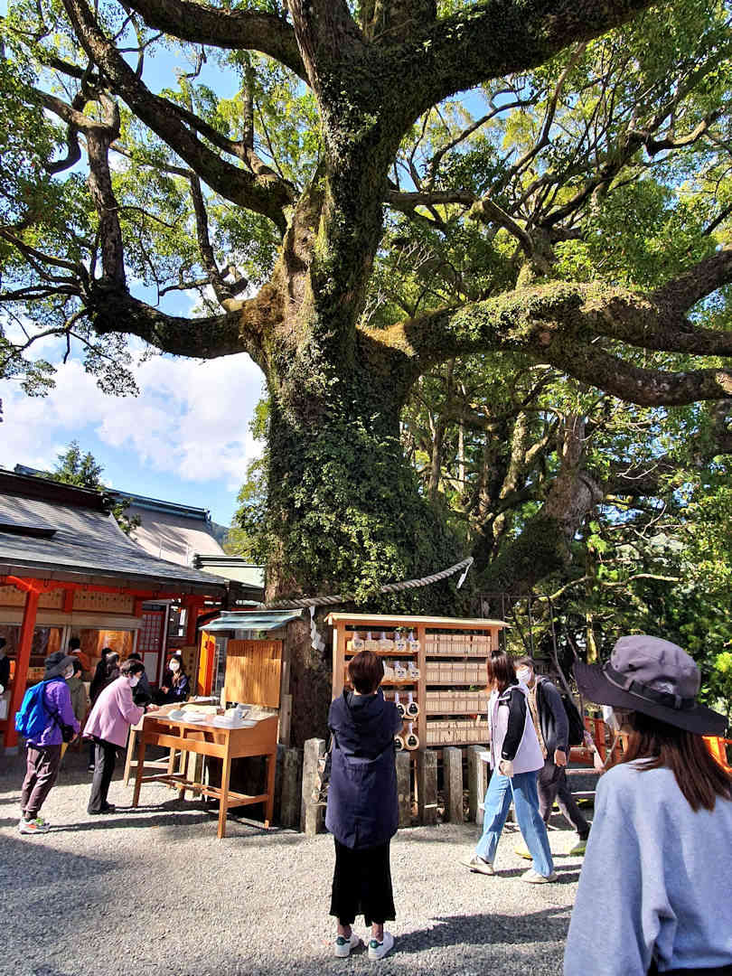
When in Nachi-san, make a wish and walk through the cavity of the sacred 850-year-old camphor tree
What else should you know when hiking the Kumano Kodo/Nakahechi route?
This article focuses on different self-guided itineraries.
If you have other questions about the Kumano Kodo/Nakahechi route, our comprehensive guide answers questions like:
- What is the Kumano Kodo like (compared to the Camino de Santiago)?
- When is the best time to hike the Kumano Kodo?
- How to get to the Kumano Kodo/Nakahechi route?
- How to book accommodation on the Kumano Kodo/Nakahechi Route?
- What about food (and water) on the Kumano Kodo/Nakahechi Route?
And if you’d like to know how much to budget for your Kumano Kodo adventure, we’ve got you covered, too.
Which Kumano Kodo itinerary did you choose, and how was your journey?
This itinerary for the Kumano Kodo Nakahechi Route is based on my experience. I’d love to hear from you if you’ve walked this path and have insights or tips to share. Your feedback could help others on their pilgrimage.
Before you go, if you liked our article and found it helpful, we would appreciate it if you could share it with your friends and family via the Share buttons below. Even better: Leave a short review on Trustpilot or Google, which would help us further build our online reputation as a (trustworthy and helpful) travel and lifestyle blog.